Friday, December 27, 2019

Nuclear Fallout Part II: the health consequences of Pyongyang's nuclear program


Pollution and health risks exists at every point along the nuclear weapons’ development chain, from the initial mining and milling operations to the enrichment process, and finally from testing nuclear devices. In this two-part article I will examine each of those areas and the health risks associated with them.

In this second part, I finish discussing the health consequences of North Korea’s nuclear program by examining issues related to their underground testing. (Part I can be read here.)

Testing


After producing the needed nuclear fuel and solving the other matters associated with creating a nuclear device, the next step is testing.

After decades of work the regime was able to test its first nuclear device in 2006. The underground test was carried out within Mount Mantap at the Punggye-ri nuclear test site. However, there is no such thing as a safe nuclear test, even when they’re underground. The original tunnel for the 2006 test was closed up shortly after the test as a result of radiation releases according to 38 North. Since 2006, five additional tests have been carried out in different tunnels. Further reporting indicates that another delayed leak was also detected as a result of post-tunneling activities in 2013.

Even under the best circumstances, underground nuclear testing still can release some radionuclides into the atmosphere. Less than optimal testing can pose a much greater radiation risk to those downwind of the test site. Initial radiation releases from a containment failure occur through “venting” but releases can continue for longer through “seeps”, where radiation finds its way out of the underground site through small fissures and openings in the overlying rock. Radioisotopes of xenon (such as 133Xe and 135Xe) are almost impossible to contain and can travel across the globe, as Canadian detectors picked them up after the very low-yield 2006 test.


Punggye-ri is in a mountainous area with little population but the main tunnel entrances are less than 2 miles away from the boundary of the Hwasong Concentration Camp. Due to the extreme human rights violations facing prisoners, we can’t hear their stories or send professionals over to determine how much radiation they have been exposed to. Residents within the larger area, however, have been able get their experiences to the broader world.

In 2017, South Korea reported that four defectors who lived in the area around Punggye-ri showed signs of radiation exposure. Defector Lee Jeong Hwa, who lived in Kilju County, said, "So many people died we began calling it 'ghost disease’…We thought we were dying because we were poor and we ate badly. Now we know it was the radiation." Unfortunately, the inability to do detailed testing on people still living in the area and gather more definitive evidence prevents us from knowing the full effects of the testing.

Negative health impacts from underground nuclear testing is easily supported by looking at the results of underground testing in the United States. According to the US National Cancer Institute, some 2,800 annual cases of thyroid cancer within the US can be attributed to the “underground era” of 1962-1992, when the United States (and the Soviet Union) was limited to testing nuclear devices underground by treaty. While North Korea has only had a limited number of tests, those tests have increased radiation levels for the region and caused an unknown level of damage to the population. Of particular concern are the 20,000 Hwasong prisoners, who are also suspected of being used as slave labor to help dig the tunnels used at Punggye-ri.

The stability of portions of Mount Mantap is also of concern after six tests, and surface changes as a result of ground shifting have been studied in detail. The first two (of four) tunnels are likely to be unusable for any future testing. Worries over accidental radiation releases from collapsing tunnels spurred China to install additional radiation detectors along their border with North Korea in 2017 and at a newly constructed border crossing in 2019.
The other two tunnels exist to the west and south and have not been used to-date. Their entrances were demolished in May 2018; however, questions remain about the irreversibility of those closures.

Occasional rumors of a possible future above-ground test (for which there are very few potential testing sites) raises the stakes even more. Radiation would flood over Japan and would reverse decades of atmospheric radionuclide decline around the globe.

Conclusion

The known risks associated with the chemicals and processes involved in mining, milling, and enriching uranium, as well as in the production of other radioactive materials, supports the descriptions of illnesses as told by unrelated sources, each with first-hand knowledge of the locations discussed.

Despite the guarantees of the North Korean constitution and international law regarding the right to favorable working conditions and the right to pick one’s career (or to leave it), expert and defector testimonies, coupled with satellite imagery, paints a very different and dangerous story. It can be said that a major humanitarian and health crisis is brewing within North Korea as we know the substandard state of their nuclear program – not just in terms of technology but also safety.

Most of the facilities within Punggye-ri’s 17-kilometer-long 
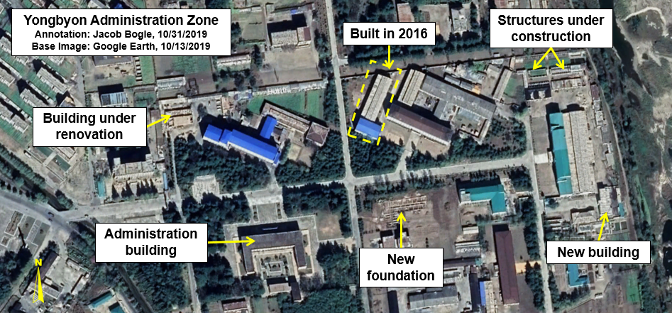
compound still stand, waiting to be used again. Yongbyon continues to grow and thousands of additional scientists, laborers, and their families have been moved in under Kim Jong Un. The mines and milling plants still produce materials to be sent to enrichment facilities. And the regime keeps working on their abilities to deliver ballistic missiles to any part of the globe. It is clear that the sixty years of nuclear harm now affecting the tens of thousands of North Koreans who have worked to develop Pyongyang’s nuclear program over three generations of Kim will continue into the future, causing more harm, more sickness, and will likely require the efforts of multiple countries to finally resolve once the Kim Era is over.


I would like to thank my current Patreon supporters: Kbechs87, GreatPoppo, and Planefag.


Jacob Bogle, 12/26/2019

Patreon.com/accessdprk
JacobBogle.com
Facebook.com/accessdprk
Twitter.com/JacobBogle

Monday, December 23, 2019

Nuclear Fallout Part I: The health consequences of Pyongyang’s nuclear program

Pollution and health risks exists at every point along the nuclear weapons’ development chain, from the initial mining and milling operations to the enrichment process, and finally from testing nuclear devices. In this two-part series I will examine each of those areas and the health risks associated with them.


In this first part, I will give a short introduction to the history of North Korea’s nuclear program and then discuss the health risks found within the uranium mining and milling process and the production of nuclear fuel. (Read Part II here


Image source: Sakucae/2.0

Introduction
North Korea can trace its nuclear program to soon after the Korean War. After the war’s total devastation, Kim Il Sung vowed that the country would never again be flattened, and he sought Soviet assistance in creating Pyongyang’s own nuclear deterrent. Marshall Stalin and future Soviet leaders weren’t too keen on Kim’s aspirations initially, but they did offer help with the development of nuclear power and signed a nuclear cooperation agreement in 1959. Never one to let an opportunity go to waste, Kim Il Sung ordered secret research into building the A-bomb.

Yongbyon, North Korea’s main nuclear research center, was constructed in the 1960s with help from the Soviet Union. Further facilities across the country were constructed that were needed to mine the uranium, mill it, and finally, to enrich it. The country has two known milling facilities, one at at Pakchon and Pyongsan, and around dozen suspected uranium mining sites. Pakchon and Pyongsan process low-grade coal to concentrate the uranium naturally found within it (at relatively low concentrations) and then to turn it into yellowcake where the uranium concentration reaches 80%. From there it is sent to additional facilities including Yongbyon, some of which have likely not been declared by North Korea to the international community.

Mining and milling
North Korea is one of only seven countries that are not signatories to the International Labor Organization. This United Nations agency sets international labor standards, including those for nuclear research and industry. Furthermore, the country’s mining sector is notoriously dangerous and lacks modern safety precautions and necessary equipment. Injuries and respiratory diseases are common, particularly in coal mines which is where North Korea gets the bulk of its uranium. The country’s two largest uranium mines, Pyongsan and Woogi-ri (within the Undok-Rason area), hold an estimated 11.5 million tonnes of ore and employ thousands of workers.

The inhuman treatment of workers at Pyongsan, and severe negligence regarding monitoring radiation exposure and air quality was given in testimony by Dr. Shin Chang-hoon before the U.S House in 2014.

Once the ore leaves the mines, it is transported to the milling plants to be converted into yellowcake. Even though coal itself is generally considered safe to handle, every form of uranium extraction leaves behind dangerous waste.

According to the United States Environmental Protection Agency,
"regardless of how uranium is extracted from rock, the processes leave behind radioactive waste....The tailings remain radioactive and contain hazardous chemicals from the recovery process."

 Google Earth image showing the residue of leaked waste material at both ends of the waste transfer pipe.

The Pyongsan milling plant is a prime example of the environmental damage done within North Korea’s nuclear sector. Satellite imagery shows that the country’s primary milling facility has been spilling industrial waste into the Ryesong River for decades, and that the waste material reservoir is unlined. This can allow contaminated water to seep into groundwater supplies and also contaminate crops. Hundreds of thousands live within the area of Pyongsan and downriver of the plant.

Non-proliferation expert Dr. Jeffrey Lewis summed it up nicely in 2015 when he said, “What is definitely happening, though, is that North Korea is dumping the tailings from the plant into an unlined pond, one surrounded by farms. That’s not a hypothetical harm.  That’s actual pollution that is harming the health and well being of the local community."

At Pakchon, which began uranium milling around 1982, a former waste reservoir is now covered in cultivated land. This practice can be seen at many mining and industrial sites. If the waste isn’t properly covered, any crops grown over this material may become contaminated with heavy metals such as vanadium and chromium, as well as lead and arsenic. Those contaminates are passed up the food-chain into animals and humans.

Image showing that a former waste reservoir is now farmland and the plant’s proximity to a river.

According to defector Kim Tae-ho, who worked at Pakchon in the 1990s, when the “experimental plant” would operate, yellow smoke would fill the plant and cause “severe difficult breathing and unbearable pain.” The short-term effect of inhaling yellowcake particles is primarily kidney damage which will resolve itself unless there is recurrent exposure (such as from working at the site each day). However, the main radiological risk comes from the radioactive gas radon and its non-gaseous “daughters” like polonium-218. Improperly vented air can lead to a build up of these radioactive materials and will cause immediate tissue damage to the lungs and mucus membranes. Additionally, the use of acids in the production process raises the risk for inhalation of sulfur-containing gases (which can have a yellow tint to them) and cause irritation and eventually burns to the eyes and lungs.
Pakchon and Pyongsan are combined mine and milling facilities, but illnesses and food contamination have been reported at stand-alone mines as well, such as at the Walbisan uranium mine (near Sunchon).

Sources told Radio Free Asia that, “local residents are forced to eat radioactive food and drink radioactive water,” and “[i]n Tongam village, the miners and their families suffer from incurable diseases or various types of cancer. In particular, many people die of liver cancer.”

Enrichment and fuel production

Even within the uranium enrichment compound, almost every inch of available land has been cultivated.

The next steps along the nuclear development chain happen at Yongbyon. The complex exists as a closed-city and people are not free to enter or exit without permission. Scientists, engineers, and others may work for many years within the fenced off complex. They will marry and will raise children.

While being able to work within a prominent field brings many benefits, it also brings risks. Brief exposure to radiation is rarely dangerous. Short exposure risks are also not catastrophic when it comes to inheritable genetic damage, either, as the world learned from the survivors of Hiroshima and Nagasaki. But continual exposure because you’re living in a contaminated environment increases those risks each day. This concern grows when you consider that in recent years, dozens of new buildings have been constructed with room for thousands more residents.

Scientists who were involved during the early days of Yongbyon’s operation have been reported to have suffered from wasting illnesses and hair loss.

Fast-forward to 2019, a former resident of Yongbyon told DailyNK,
"In other districts it is very difficult to find people with cleft lip but here there are many individuals with crooked mouths, those lacking eyebrows, incidents of dwarfism, and those with six fingers. There are even children who just look like bare bones."

Adults can also be affected, with the most severe cases eventually causing mental deficiencies, cancers, and wide array of other illnesses at relatively young ages.

The aforementioned Dr. Shin Chang-hoon also interviewed a defector who worked at Yongbyon. He was told that the dosimeters (which measure radiation exposure) were only checked every three months and workers were not told of the results unless they had already begun to exhibit signs of radiation sickness.

Adjacent to an area of improperly stored nuclear waste is a grove of dying trees and farmland. It is only separated from the waste by a covering of dirt.

Improper disposal of radioactive materials can pollute the soil, kill trees, and contaminate any food that is grown in the area. Releases of gases into the atmosphere will likewise blanket the region and small, aerosolized particles will eventually make their way down to the ground, bringing with them radiation or forming toxic compounds. These gases can travel for many miles and place other sites within North Korea at greater risk, not just the immediate Yongbyon complex.


Concern over Yongbyon is especially grave considering the large number of nuclear and chemical facilities in such a small area. Not just in terms of ongoing dangers that defectors have told the world about, but also in terms of a future accident, flood, or fire that could devastate the region and require international intervention to solve. 

The fact North Korea is largely cut off from the world and often must rely on outdated science, manufacturing techniques, and potentially unreliable indigenously produced parts and equipment means that the risk of accidents and errors is greater than in other nuclear countries. It is something of a small miracle that a large-scale incident hasn’t already occurred.


I would like to thank my current Patreon supporters: Kbechs87, GreatPoppo, and Planefag.


--Jacob Bogle, 12/22/2019
Patreon.com/accessdprk
JacobBogle.com
Facebook.com/accessdprk
Twitter.com/JacobBogle

Tuesday, December 17, 2019

Major Expansion at Pyongyang Training Ground


The Soe-gol military training facility in Pyongyang has undergone major changes in 2019.

The military base, which consists of a military operations on urban terrain (MOUT) section and open training grounds, may be most well-known for a set of military exercises carried out there in October 2016 which was caught on satellite imagery.


Situated near the village of Soe-gol, 6 km south of Kangdong, the base is in the process of becoming a major training center.

The base appears to have been constructed sometime around 2001-2003 and the MOUT facility had been built by 2005. Lying within the Pyongyang region, it is part of the Capital Defense Corps and is used to train some of North Korea's most important troops.

MOUT facility in 2005.

The MOUT facility has mock buildings aligned along a central "boulevard" and the first buildings constructed have designs reminiscent of South Korean architecture of the 1970s. Newer buildings have been constructed over the years and their designs reflect more current building trends in the south.

MOUT facility in 2019.

Between 2007 and 2011, the base underwent a first stage of expansion and another expansion stage occurred in 2016. These expansions saw additional mock buildings constructed at the MOUT facility and added targets at the smaller vehicle driving and firing range to the south.


The driving and firing range has existed since the base was constructed and includes a short driving course, stationary vehicles for target practice, and a small number of obstacles. Other than the addition of painted targets in 2016, little else has changed. The entire original driving range (not all shown in the above image) covers an area of just about 0.25 sq. km.

The biggest changes have been ongoing this year and are located within the large open fields of the base complex. There were some minor changes made in preparation of the 2016 exercises, but the latest upgrades dwarf any preceding it.

The new driving range occupies approx. 1.7 sq. km. making it nearly seven times the size of the old one. It includes a main driving course consisting of two roads which total a combined 11 km when shorter, secondary paths are also included.

Image showing the general main driving course. There are two lanes (which occasionally diverge paths) as well as secondary routes. Taken together, they total over 11 km.

This new training course includes multiple obstacles, terrains, intersections, and a "bridging task".


What I'm calling a "bridging task" is either one of two things, as I am uncertain as to its exact nature.
Trainees drive up an elevated road which isn't connected to the lower elevation continuation of the road. The most recent image shows a basic bridge crossing the gap. That bridge is either permanent but teaches recruits how to cross an unstable structure in heavy vehicles or it's actually a bridging operation where the recruits must place a temporary bridge (similar to the US Rapidly Emplaced Bridge System) over the gap and then cross over it.

This next series of images will show the construction of the training site.

Construction of the elevated portion is underway in February 2019.

By April 3, the elevated section is completed and the roadways are being built.

Bridge sections are in place by April 21, 2019.

The crossing span at the two gaps is between 15 and 17 meters which is technologically possible with current bridging vehicles such as the MT-55A which has a folding bridge 20 meters long and is in North Korea's inventory.

As I have mentioned in previous articles, North Korea is much more than nuclear weapons. Their conventional forces continue to be a major regional threat and the regime is pouring countless millions into upgrading their capabilities and training capacity on the ground, at sea, and in the air.


I would like to thank my current Patreon supporters: Kbechs87, GreatPoppo, and Planefag.


--Jacob Bogle, 12/16/2019
Patreon.com/accessdprk
JacobBogle.com
Facebook.com/accessdprk
Twitter.com/JacobBogle

Sunday, December 15, 2019

DPRK Gas Station Survey

Keeping an eye on every aspect of North Korea, be it their nuclear sites or more mundane things like gas stations, is the only way we can create a deeper understanding of what's happening within the country despite the limited amount of official data coming from Pyongyang.
Regardless of sanctions, North Korea's domestic economy continues to grow ever so slowly and taking a look at the transportation sector helps to shed light on this growth.

As the economy rebounded after the famine and subsequent economic collapse, market activity helped spur greater internal travel for trade and even domestic tourism (something that was largely absent for much of North Korea's history). Private car ownership is still rare, but the streets of Pyongyang and other major cities have steadily filled up, with the occasional traffic jam even being seen. Taxi services, buses, motorcycles, and private transportation companies (typically not entirely legal) all require one major commodity to function: fuel.

National map of the 113 gas stations I was able to identify.

South Korea has approximately 11,800 gas stations. With half the population, North Korea might be expected to have half the number of gas stations: 5,900. After looking at every major town and highway, I was only able to identify 113 gas stations in all of North Korea. However, while that number may be small, it actually speaks to the fact that vehicle ownership, mass transit, internal travel, and the domestic economy have all undergone rather significant changes under Kim Jong Un, as over half of those gas stations have been constructed since he came to power in Dec. 2011.

Wonsan gas station "Number 1". Despite the city's importance, I was only able to find three stations.

Wonsan gas station "Number 2" as seen on Jan. 30, 2014 under construction.

The need for and consumption of more refined petroleum raises its own set of questions.
Based on measuring the fuel tanks at the second Wonsan station pictured, if we make these few assumptions, that each of the 74 identified stations built in or after 2012 were indeed operational and each held two uniform-sized fuel tanks, and each one was refilled once a month, then that equals an annual consumption of 15.2 million gallons for those 74 stations. That added consumption equates to an additional 363,000 barrels of refined petroleum product above what North Korea was using under Kim Jong Il and above the annual import limits in place through sanctions. United Nations' reports and various countries all accuse North Korea of violating the sanctions regime. The expansion of gas stations suggests that advanced sanctions evasion practices are how they have been able to keep their gas stations full and their cars fueled.


For a more detailed report, please see my article at NK News Pro.

Patreon Special Access
Patreon supporters at the $20 tier are entitled to exclusive data sets. The Google Earth file for this post is one of those exclusive offers. This is the only nationwide map of the country's gas stations that I am aware exists. Please consider supporting me on Patreon and get access to the details behind this survey and other exclusive information.

I would like to thank my current Patreon supporters:  Kbechs87, GreatPoppo, and Planefag.

--Jacob Bogle
Patreon.com/accessdprk
www.JacobBogle.com
Facebook.com/JacobBogle
Twitter.com/JacobBogle

Friday, December 6, 2019

Chongjin Prison Camp Update


Chongjin Prison, officially known as Kwan-li-so No. 25, is a North Korea prison near the city of Chongjin. Unlike sprawling camps like Hwasong or Kaechon, which occupy many square miles of territory, Chongjin is relatively compact, with prisoner housing and forced labor facilities all within a single walled compound. The one exception being an agricultural area that is surrounded by a fence.


Chongjin has undergone various changes over the years, one of largest being an expansion of the outer perimeter in 2010, and then the addition of a mining site in 2014. The most recent change is within the light industrial section of the prison.


All North Korean prisons use forced labor to engage in a range of activities from agriculture and light industry to mining and sewing clothes and uniforms. At Chongjin, its 3,000 prisoners must engage in agriculture, livestock activities, mining, and light industry. However, major changes to one of the factory buildings has been ongoing this year.

The factory building in question is approx. 185 feet by 105 feet in size. Its initial demolition had begun by February 2019 and only the basic framing of the building remained by March 15. An apparent partial roof section was placed on the structure by April 5. Little else has happened as of July 22, 2019 which is the latest Google Earth image available. As of that time, the factory sits as just a shell and is missing the vast majority of its roof.

In this February 2019 image, you can see that some portions of the roof have been removed.

By March 15, only the metal frame of the building remains. The roof has been completely removed.

A partial roof coverage was added to the central hall by May. The outer wings of the factory are still without coverage as are other parts of the central hall.

The addition of roofing material in May (no matter how incomplete) suggests that the factory isn't being completely demolished. The prison managers possibly decided to either change the activities at the building or to begin a process of renovation. As of July 2019, nothing else had changed since May.

With occasional rumors about various prisons being closed or large prisoner transfers, it's important to keep an eye toward any substantial changes such as this. One less factory could be an indication of fewer prisoners. However, I need to stress that that can't currently be inferred as the basic structure still stands and no other substantial changes to the prison complex has been identified.


Related reading: Prison Camp 22 Today (AccessDPRK, Nov. 1, 2018)


I would like to thank my current Patreon supporters: Kbechs87, GreatPoppo, and Planefag.


--Jacob Bogle, 12/5/2019
Patreon.com/accessdprk
JacobBogle.com
Facebook.com/accessdprk
Twitter.com/JacobBogle

Wednesday, November 27, 2019

Ryongsong Palace Fortress

Located in Pyongyang, the Ryongsong Residence (also called Residence No. 55) is the primary family compound for Kim Jong Un and family.


Security is always tight at the various palaces and villas across the country that the Kim family uses, however, Ryongsong takes security to an entirely different level. More than just some pleasure palace with horses, ponds, and massive dining halls, Ryongsong is a keystone in protecting the heirs of Kim Il Sung. Not only is it surrounded by densely wooded hills, fences, walls, and comes with an enormous security detachment, it actually sits at the very heart of the capital's air defenses. It may be the most well-guarded residential compound in the world.

Initially constructed by Kim Il Sung in 1983, the compound has undergone many changes over the years and has helped keep the Kim family protected and in power despite rumored assassination attempts and amidst millions of starving people during the famine.

The primary compound is approximately 11.3 sq. km. (4.37 sq. mi. or 2,800 acres) There are other smaller annexes that directly abut the main facility, but they are for security, maintenance, staff housing, buffer zones, etc. The addition of these annexes brings the total area of the compound to 12.9 sq. km (5 sq. mi. or 3,200 acres).


Getting inside the compound can only be done through two direct routes, a special train station and a single access point from a highway. All other entrances into the primary compound must go through one of the annexes or other circuitous routes which prevents random wanderers from finding their way to a check point and prevents anyone from using a vehicle to try and bash their way in directly. It's simply not possible.


The main entrance is located 680 meters away from the highway, allowing security to observe oncoming vehicles. The entrance itself is consists of two thin roads parallel to each other that make their way through layers of electrified fencing and a series of walls and ditches so steep and wide that they could stop tanks. The entrance site is flanked on both sides by wooded hills providing further protection.

Further inside (about 740 meters), another ditch and fence system surround large parts of the compound. Traffic on the roads may move freely over it, but any large-scale intrusion would be forced to use those roads which would serve as a choke point and allow security to destroy whatever was coming. This internal set of fencing serves as the main encircling layer of protection. Every so often are observation posts and even machine gun emplacements.

From there, roughly 1.6 km along the road, is the primary residential compound. It has its own set of fencing, entrance gates, and other security features.


The various fences within the main residential area.

Close-up of Kim Jong Un's palace security.

Beyond the physical barriers that wrap the family in a cocoon of safety, are the guards themselves. The Supreme Guard Command (also known as the Escort Bureau) is an elite security unit of upwards of 120,000 soldiers that are tasked with protecting Kim Jong Un, his family, and any other elites he would designate. Kim Jong Un has his own personal security detail of unknown size, however Kim Jong Il's numbered some 200 personnel. Outside of that immediate pocket of protection, the Guard mans the numerous security posts and machine gun nests of Ryongsong. They are also responsible for security at all of the other palaces and assist in keeping the leadership train and elite aircraft secured, in conjunction with other special units.

By comparison, the US Secret Service has around 7,000 employees, but they're split between their duel objectives of presidential protection and fighting counterfeiting. That isn't to say anything of their amazing capabilities, but the Secret Service is greatly dwarfed in numbers.

The geography of the Ryongsong area helps protect the palace from ground attacks and the multiple, nested check points make storming Kim's personal villa practically impossible. That leaves the open skies...which aren't really all that open.

In terms of air defense, Pyongyang's airspace is probably the most well defended in history. Their weaponry may be aging but the city is still surrounded by ring after ring of air defense sites. The capital region has 19 surface-to-air missile (SAM) sites and around 400-500 anti-aircraft artillery (AAA) batteries that are arrayed into three main rings.

SAM coverage area (outermost two rings) is approximate and based on the S-125 (SA-3) system. The other four rings are based on a range of 4 miles for the AAAs (this is for simplicity as North Korea employs a mix of systems). The fourth AAA ring (yellow) is the dedicated palace air defense ring, with Ryongsong (in blue) in the middle. This simplified view was created based off of key "anchor points" and is for illustrative purposes only.

While these sites are supposed to be about protecting the capital and its 2.5 million residents, when you observe the air defense system in its entirety, you find that there is a fourth ring of AAA batteries aligned specifically for the palace, and that Ryongsong is actually within the coverage area of the entire system. Between SAMs and AAAs, Ryongsong sits at the heart of a total of six defensive rings. The complex is, indeed, the most well defended residence on the planet.

Kim's security and the reach of Ryongsong extend beyond its fences. The leadership train station at the palace connects to 20 others across the country, providing Kim with a secure and rapid way to escape to other palaces or even to an underground rail complex in N. Pyongan Province. Several other palaces are rumored to be connected to each other via tunnel as well. Ryongsong is also within six miles of an airfield and a dedicated, hardened heliport that could spirit Kim to other areas or even out of the country if needed.

North Korean ideology and law place Kim Jong Un at the head of the Korean Workers' Party, the state, and military. Underscoring that point, state media released a statement regarding the execution of Kim's uncle, Jang Sung-taek, that said, "No matter how much water flows under the bridge and no matter how frequently a generation is replaced by new one, the lineage of Paektu [Kim Il Sung] will remain unchanged and irreplaceable.
Our party, state, army and people do not know anyone except Kim Il Sung, Kim Jong Il and Kim Jong Un."

The efforts put into Ryongsong and the protection of the Kim family embodies that reality.


I would like to thank my current Patreon supporters: Kbechs87, GreatPoppo, and Planefag.

--Jacob Bogle, 11/27/2019
Patreon.com/accessdprk
JacobBogle.com
Facebook.com/accessdprk
Twitter.com/JacobBogle

Monday, November 11, 2019

Mystery at the National Defense University

Pyongyang's National Defense University (recently renamed the Kim Jong Un National Defense University) lies to the north of downtown Pyongyang in an area full of military and secret security schools and training centers. The NDU is located next to the Second Academy of Natural Science (which goes by several other names) as well as near the Kim Jong Il People's Security University.


The NDU has undergone several changes since Kim Jong Un's rise to power but one that hasn't received much attention is a small addition constructed in 2014. It was noted in the AccessDPRK Phase II map release in 2017, but I didn't know much about it and it lay forgotten until now.


The area in question is a small, tunnel-like structure or bunker that was set into the side of a hill. It also has an opening in the roof of the structure. 

Initial excavation work began in 2013 but the structure wasn't constructed until 2014. In Sept. 2014, apparent damage to the roof of the nearby white building was also observed. There has been a building on that site since at least 2000, however, it was reconstructed in late 2013.
To my eyes, the damage looks like there was a small explosion of some kind that blew through the roof. 


Since then, another building was constructed nearby in 2016 and an existing building was demolished in 2017. Additionally, during 2014, roughly 245 meters to the north-northeast of the bunker, a small structure was built on a hill. It resembles an observation hut, but there is some question if there is a clear line of sight from the hut to the bunker. It may just be an observation hut for activities happening in another part of the university compound that was simply constructed at the same time.


In Sept. 2019 I decided to try and solve this little mystery. I reached out to Joseph Bermudez, senior image analyst at the Center for Strategic and International Studies, and to Joshua Pollack and David Schmerler, both senior research associates at the James Martin Center for Nonproliferation Studies, to see if they could lend any insight.

Not being a missile expert, my initial thought was that the site may have been a horizontal test structure for testing either small scale-models of rocket engines or to test certain pieces of technology. I came to this conclusion because A) the NDU has been involved with the development of North Korea's missile technology, B) I thought that the opening would allow engine exhaust to flow out without damaging the rest of the concrete structure, and C) because learning about complex systems require learning about the fundamentals first. As with rocket hobby groups elsewhere, the bunker could be used to familiarize students with simple examples of solid fuel rocket engines. 

Unfortunately, none of the three experts seemed to think my idea was right, and all gave their own various reasons for that. So, still left with a mystery, I asked them what their impressions were. 

Joseph Bermudez said that his initial thoughts were that it's either a small firing range for handguns or a small explosive ordinance disposal (EOD) site for "training/familiarization". He also said that the damage to the roof of the other building couldn't be positively identified without doing more in-depth image analysis, but that it didn't necessarily have to have been caused by an explosion.

I doubt that it is a firing range because many examples of those exist, both large and small, and none take on this form, but some kind of EOD site does makes sense.

Joshua Pollack also raised the possibility of the bunker structure having to do with explosives, either training or testing. David Schmerler called its utility for substantial testing/training into question because of a general lack of infrastructure to move vehicles and equipment around (access to the site is through dirt paths). However, small vehicles can make it to the site and small-scale experiments/training could be carried out.

In conclusion, there is no conclusion. While the general consensus is that it may have something to do with explosives, there still exists the questions of what kind of explosives (weapons, demolition, solid rocket fuel, etc.) and for what purpose (testing, disposal, training). As it stands, the site doesn't currently seem to be easily identifiable, it appears to be the only structure of its kind in the country, and generally remains a mystery. Perhaps as time goes on and newer images of the site become available its function will become clear. Until then, I have another North Korea Mystery to add to the list.

If you have a credible explanation (or better yet, proof) of what the site is or additional information that may be useful, please feel free to comment or otherwise get in touch.


I would like to thank my current Patreon supporters: Kbechs87, GreatPoppo, and Planefag.

--Jacob Bogle, 11/10/19
Patreon.com/accessdprk
JacobBogle.com
Facebook.com/accessdprk
Twitter.com/JacobBogle

Saturday, November 2, 2019

Recent Growth at Yongbyon

The Yongbyon Nuclear Research Center is North Korea's primary nuclear facility. It contains multiple reactors, research facilities, radiochemical laboratories, and a uranium enrichment facility.

5 MWe Magnox reactor at Yongbyon. Image: Wikimedia Commons

Yongbyon (named for the ancient nearby walled city) was constructed from 1961-1964 with Soviet assistance. It took on the style of a Cold War-era "closed city" and is cut off from the rest of the country. It lies within a secured compound covering 24.8 sq. km and is protected by 22 primary checkpoints and internal gates. It is further defended by an array of nearly 40 anti-aircraft artillery batteries which encircle the region. Over the decades North Korea, along with its foreign benefactors, has spent billions constructing the site. Based on inflation, the initial start-up costs of Yongbyon was over $4 billion (or $500 million in 1962 dollars).


While Yongbyon is contained within a defined security perimeter, it is divided internally into two main sectors: the civilian, residential area (also known as Bungang-ri) and, to the east, the nuclear facilities themselves which form an axis of distinct research and production complexes centered along the Kuryong River that flows through the area.

Over the years, Yongbyon has grown substantially. New housing, new reactors, and new laboratories keep popping up. Even when the reactors enter stages of relative inactivity, the surrounding site continues to expand. The unofficial nuclear truce between North Korea, the United States, and South Korea that the country's leaders have tried to create in recent years hasn't done much to halt the growth of Yongbyon.


Until recently, the "newest" Google Earth imagery of the area was from 2016. Reporting by groups like 38 North have noted the occasional new building being constructed over time as they have focused on specific parts of Yongbyon and purchased newer commercial images for that reporting.

Recently, however, Google Earth updated their imagery for the entire area. Dated October 13, 2019, we can now immediately observe three year's worth of changes over miles and miles of territory in and around the nuclear site. It also gives us a chance to observe changes missed by other reporting or totally ignored (such as the residential area).


After looking over the closed-city, I was able to note 23 changes in the form of new construction or buildings being repaired/renovated.
You'll note that most of the changes occurred within the residential zone and inside the administration/reactor zone (where the 5 MWe and 50 MWe reactors are located).

I'll start with changes to the residential zone (Bungang-ri).


The two main changes in this area shown is that several new apartment blocks are under construction and the road has been widened. Apartments were also built in 2016. Access to Yongbyon is severely restricted and you must have the necessary permits to live there (and must receive permission to leave). This means that any large population growth is purposeful and comes from the government bringing in new scientists, engineers, and their families.

Concerns have been raised over the years about the health and well-being of the thousands of people that live here and work at all of the various facilities. While residents receive better food rations, greater opportunities for their general advancement in life and the advancement of their children, the area is reportedly heavily polluted. In 2019, a former resident of Bungang-ri told DailyNK that,

"In other districts it is very difficult to find people with cleft lip but here there are many individuals with crooked mouths, those lacking eyebrows, incidents of dwarfism, and those with six fingers. There are even children who just look like bare bones."


Near the city center, even more apartments have been constructed. These are around six stories in height. When added to the ones discussed above, at least 300 new apartment units have been constructed since 2016. Going further back, it's likely the population of Bungang-ri has grown by 2,000-2,500 under Kim Jong Un, based on the number of apartments constructed since 2011.

Construction of the noted underground site began in 2004 and is one of several within the complex.


Population growth has led to the need to build other, non-residential buildings. At least three have been added (or are currently under construction) and there may be a fourth under construction as well. One interesting note, as gas stations have proliferated at major cities across the country, one isn't visible in Yongbyon. There are plenty of reasons why that may be, but one could be because the average citizen can't leave or go trading as easily as people outside of Yongbyon, so the regime doesn't see a need to build a fueling site for passenger vehicles.

Yongbyon's sealed nature has likely created a situation where the regime's propaganda, cult of personality, information controls, and level of market activity have all been less subjected to change or challenge verses the rest of the country.


This next image shows changes to the primary administration and research zone. Multiple structures are in the process of being constructed and at least one appears to be undergoing some kind of renovation. I have also highlighted an addition to a research facility that was built in 2016.


To the immediate north, two new structures can be seen next to the IRT-2000 research reactor building. The reactor was provided by the Soviet Union in 1965. The Soviets provided North Korea with a total of 42 kg of highly enriched uranium until 1990. Pyongyang has said that the reactor produces needed isotopes for medical research and treatments, but the reactor can also produce tritium for their weapon's program. By 2011, it was widely believed that the Soviet-supplied fuel had all been used. However, it is now suspected that the reactor is using domestically created fuel.

The garden has existed for many years and is part of the regime's mandate that military units, schools, factories, and pretty much everywhere else do their part to solve the country's food problem. The food could be eaten by those working there or it may be sold in markets to earn currency. Looking at all of Yongbyon, you'll find nearly every free space of land is being used for cultivation. If defector and witness reports are correct about major pollution, then any food grown here will also be contaminated. This echos problems seen at other nuclear-related facilities, such as the uranium mine and milling plant at Pyongsan.


Several changes can be seen at the Yongbyon reactor zone. A new office building was constructed, and two smaller support structures built. The heavy-lift crane site has also undergone significant changes.

The crane structure was first erected in 2011 as part of the construction of the experimental light water reactor. The long, angular structure could be warehouses or contain a conveyor system. This was noted by 38 North and shows that the changes began in 2017 and continued into 2018.

While there are questions about the current operational nature of the reactors, the area has been very well maintained, had new construction, and stands ready to resume work whenever the orders are given.


Between the reactor zone and the nuclear fuel production zone lies a facility for maintenance and supplies. A large new building is currently under construction there. Its size and the visible structures inside suggest that it is likely an administration building to coordinate various construction and maintenance activities around Yongbyon.


The compound holding North Korea's uranium enrichment and nuclear fuel production center has likewise seen several additions.

Two small buildings have been constructed next to the enrichment facility, a building has been added to the isotope facility (lower right), and a building that had long appeared to have been abandoned has been repaired/reconstructed.

The new building at the lower right was pointed out in a 2018 report by 38 North.


Lastly there is some construction work happening right outside of a main security compound to the east. Two buildings are currently under construction (space for a third exists but no foundation work has begun). I don't know if the site is directly related to Yongbyon but it is extremely close to the electrified fence that surrounds the complex and is next to a key entrance point.


Not only is it possible to see that many changes have happened since 2016 (which, of course there would have been), but we can see that there are structures currently and actively being built. All of this points to an active city with a growing population, improved research and production capabilities, and is substantial evidence that North Korea isn't giving up on their nuclear program anytime soon. The continued mining and milling of uranium at Pyongsan, the fact that almost every building along the 17-km stretch of Punggye-ri still stands, and new progress toward creating submarine-launched ballistic missiles paints a picture very different than the one promoted by various media and political outlets.

Handshakes, signatures on paper, and hope all must give way to what is actually happening on the ground. And what is happening on the ground is telling.


This report also speaks to the ongoing need for continuing updates to Google Earth and other freely accessible products that give access to satellite images of the globe. Buying enough commercial imagery to cover all of Yongbyon can run into the thousands of dollars and places restrictions on research. While commercial entities enable individuals and news and research organizations to look at very recent images of specific sites, which does provide immense value, it also places limits on more comprehensive research into larger areas and often means that a good deal of North Korea gets overlooked.
However, so long as Google Earth (and even general map providers like Bing) continue to provide the world with their services, the democratization of research can continue. Be it looking into North Korea, changes to the Amazon rain forest, new internment camps in China, or the agricultural outputs of France, the world relies on open access to information.


I would like to thank my current Patreon supporters: Kbechs87, GreatPoppo, and Planefag.

--Jacob Bogle 11/1/2019
Patreon.com/accessdprk
JacobBogle.com
Facebook.com/accessdprk
Twitter.com/JacobBogle