Sunday, November 20, 2022

Possible Detention Centers Built Across Country

Known locations of new facilities.

Normally I don't like to write posts about unidentified things. Plenty of speculation exists about what goes on in North Korea as it is, and I keep this page updated with small finds that I am curious about. But I am very interested in discovering the point behind what is a nationwide project, not simply a single site. So I want to have the space to describe what I've found in as much detail as I can, offer a few ideas, and reach out to the public for any additional information that may exist.

Earlier this year I came across a site in Hyesan that looked a lot like a newly constructed prison. Although small, it had a wall, an outer perimeter fence, and guard posts. I couldn't find any news stories about new prisons being constructed and I didn't know of any other examples, so I wrote a small write-up in the AccessDPRK Monthly Digest which is sent out to Patreon supporters as an "interesting find".

Months later I found another similar facility and then another. Currently, I have 34 located.

New facility in Hyesan.

This site in Hyesan (41.385223° 128.199295°) was the first one I found and was constructed in 2021 but it's not the oldest. There are three others that were built in 2019. However, the rest were all built between 2020 and 2022.

They all share a few similar characteristics. They each have one (typically) small central building, that building is surrounded by a wall, and that wall is then surrounded by one to two layers of fence. There is also a guarded entrance into the fenced area, and there's at least one guard tower somewhere in or around the complex.

Sixteen of the thirty-four sites are built around previously existing buildings that had an unknown original purpose; although, they are associated with nearby agricultural activities. Additionally, most sites are located along the outskirts of the town they're in. 

Nearly all of the sites consist of one or two small buildings within the walled section, but the largest is located in Unsan (40.112068° 125.922696°) which is a whole complex of previously existing buildings that have a combined footprint of approximately 1,400 sq. meters. The smallest ones take up a mere 90 sq. m. while most fall between 130 and 200 sq. m.

The compound in Chongnam. It was constructed in a field in 2020/2021.

As well secured as these sites are, most are basically the same size as a modern middle-class house you might find in Denmark or Japan, with the larger sites being of similar size to a house in the United States. With that in mind, their size makes the idea of them being jails less probable. Particularly as every county in North Korea already has detention centers as part of Ministry of Social Security and Ministry of State Security facilities.

Standalone provincial prisons and the more well-known prison camps are also substantially larger than these sites. And, so far, most major cities lack these new facilities while several small towns have them, adding to the mystery.

If they're not jails, another option is that they're quarantine facilities for those who test positive for COVID-19.

North Korea has created a number of quarantine facilities throughout the country over the course of the COVID-19 pandemic as towns and regions would be placed under lockdown. These sites typically take the form of special hospital wards or commandeering existing facilities and re-tasking them for the purpose of medical isolation. 

Under the authority of the State Emergency Anti-Epidemic Command, the Ministry of State Security and the Military Security Command have been given charge of enforcing the government’s anti-pandemic policies and ensuring quarantine measures are followed. Quarantine in the country has taken the form of keeping individuals quarantined at home, establishing mobile response units, and creating stand-alone facilities that can take in quarantined individuals and provide them with basic medical support.

Despite two years of state denial that the illness was in the country, numerous reports have been noted of “fevers” striking one city or another throughout the pandemic. However, all of that changed in May 2022 when the government officially acknowledged that there were COVID-19 cases in the country and further admitted to millions of other cases of a rapidly spreading “fever”.

Regardless of Pyongyang’s new willingness to discuss the presence of disease among the population, many experts believe that COVID-19 has existed in North Korea almost as soon as the virus began to spread out of China, and lockdowns have been noted throughout the country including in Pyongyang, Kaesong, and, of course, Hyesan.

According to DailyNK, “Chapter 2 of Article 16 of the emergency quarantine law calls on central health authorities, local people’s committees and other relevant bodies to create quarantine facilities “in keeping with quarantine and containment demands” to separate and isolate infectious disease patients, suspected cases and contacts.”

And in 2022 it was reported that the government was going to start building permanent sites to isolate and treat patients; whereas many of the previous locations were temporary and only lasted for as long as a local outbreak did. But as "fevers" have been spreading sporadically since the very beginning of the pandemic, it's likely that the government had already embarked on constructing purpose-built quarantine facilities regardless of their public admissions. 

As North Korea's healthcare system is broken and Kim Jong Un has refused to import vaccines, the country's only real line of defense is to isolate people.

So, could these be quarantine centers? The fact that nearly all of them have been built after the pandemic began and are often positioned outside of a town's urban area would support this notion. But they are still quite small and would ideally need to include a patient ward, room(s) for administration and offices, a supply room, and bathroom facilities.

If the government feels COVID is an existential threat to the country, every effort should be expended to ensure proper treatment and safety. One might look at the emergency hospitals constructed in Liberia during the 2014-2016 Ebola outbreak or pop-up centers built in the rest of the world during the early stages of COVID.

The main Ebola treatment center in Monrovia, Liberia during the 2014-2016 outbreak.

These small, single-building compounds, while secure, do not seem like the best facilities to serve as medical sites. Nonetheless, it's hard to come up with alternate explanations for their construction.


Other possibilities are that they're military storage sites (such as for ammunition), grain facilities, or perhaps even barracks to house mobilized workers doing local construction.

I don't think they're any of those three things. 

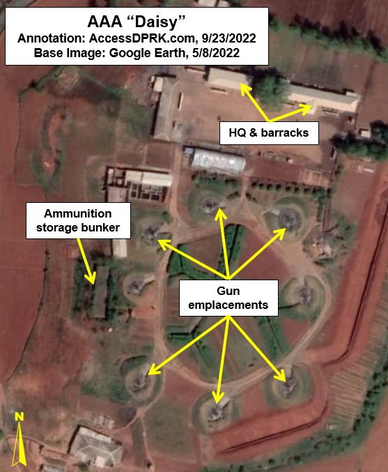
These sites are not located within military bases, and they lack the protective earthen berms used to contain explosions in the event of an accident that are common to such storage sites. 

The design of grain facilities is fairly well understood, and they are considerably larger as well. Although they do have perimeter walls, they do not have a second layer of fencing and they are comprised of multiple buildings. The AccessDPRK 2021 Map has around 900 of these sites located.

A typical grain storage/drying and distribution facility. Located at 38.320893° 126.139527°.

Lastly, the I am not sure why a mobilized labor unit would need to be housed behind fences. Temporary worker's housing and workshops are a regular feature of construction sites, and they lack defined boundaries (like fences or walls). And even though mass labor may not be entirely voluntary, the camps are hardly treated as dangerous places in need of tight security. Additionally, I haven't noticed adjacent construction work at any of the identified locations. 


I have reached out to several individuals and organizations involved in human rights and imagery analysis for comment and almost no one even knew of their existence, let alone what they were for. So the main purpose of this article is to call attention these sites and to describe them as best as I can.

I still believe that they are some kind of detention center. Perhaps to quarantine positive COVID cases, perhaps as part of a larger rejuvenation of the country's penal system, or perhaps for something else. Unfortunately, in this case, it's difficult to come to a confident conclusion based on satellite images alone. Once more concrete information comes to light, I will update the article accordingly. 


I would like to thank my current Patreon supporters: Alex Kleinman, Amanda Oh, Donald Pierce, GreatPoppo, Joel Parish, John Pike, Kbechs87, Russ Johnson, and Squadfan.

--Jacob Bogle, 11/19/2022

Monday, October 24, 2022

Mining and National Defense

North Korea has always struggled to supply its armed forces with modern weapons and technology. Major reasons for this can be traced to the flaws inherent to a command economy, the collapse of the Soviet Union, and more recently, multiple layers of international sanctions as a response to North Korea's nuclear program.

However, what North Korea lacks in advanced technology or from their lack of access to international markets, the country endeavors to make up for by using an ever-growing military-industrial complex fueled by indigenous designs and manufacturing processes (with the help of occasionally stolen/illicitly acquired foreign research). 

To facilitate this, as every country strives for, North Korea seeks to extract domestic supplies of strategic raw materials for their tanks, planes, and missiles.

For the United States, the National Mining Association noted that there are 46 metals and minerals that are critical to national security and yet accessing adequate supplies requires overseas imports. If a country as mineral rich as the US needs to import so many raw materials, the situation can only be worse for much smaller North Korea.

Geology and distribution map of major mineral deposits in North Korea. 
Image source: Koh, Sang-Mo & Lee, Gill & Yoon, Edward. (2013). Status of Mineral Resources and Mining Development in North Korea. Economic and Environmental Geology. 46. 10.9719/EEG.2013.46.4.291.

Through the 1950s and 1960s, Soviet and Eastern European geologists conducted several surveys of North Korean territory to find what mineral deposits existed and which ones could be extracted. Later surveys by Chinese, Japanese, South Korean, and other firms have since refined those earlier efforts.

This enabled the country to expand its access to things like iron, copper, and coal. And recent estimates suggest that North Korea could be sitting on $7-10 trillion in mineral wealth, opening up greater opportunities to provide the raw materials necessary to fuel its defense needs, even if the country still lacks some the materials used in the most advanced technologies (such as beryllium).

Complicating matters, however, is that its mining industry remains underdeveloped and North Korea's technical ability to cast, forge, alloy, and otherwise fully exploit the properties of a number of these materials remains limited.

From copper to zinc, the capacity to mine (or produce synthetically in the case of certain nuclear elements) these materials on North Korean soil would give the country a buffer against sanctions and enable them to continue work on more and more advanced technologies including a modernized nuclear arsenal. To this end, new rounds of investment in the mining industry has occurred from both domestic and international sources, and the country has been able to open new mines, reopen others shuttered years ago, and maintain operations at their key facilities.

The AccessDPRK Map 2021 Version located 2,001 mining locations. A plurality of these mines are coal mines, but coal mines offer more than a fossil fuel and can be a source of numerous other minerals. And although many individual mines in North Korea are unidentified, the minerals extracted can be determined visually for some, and others are indeed publicly known. This gives me the opportunity to list a number of specific mines that likely play key roles in providing raw materials for North Korea's national defense.


Pyongsan Uranium Mine and Concentration Plant (38°19'28.46"N 126°26'12.29"E)

According to researchers Sherzod R. Kurbanbekov, Seung Min Woo, and Sunil S. Chirayath "North Korea has at least 4 million tons of natural uranium ore reserve for industrial development, and hence total natural uranium feed available is 4,000,000kg (assuming 1000ppm ore quality). This means that the DPRK program is not constrained by the availability of natural uranium." 

That's enough for around 700 highly enriched uranium-based nuclear warheads and would supply their nuclear program for years to come.

North Korea has several large uranium deposits in Pyongsan, Pakchon, Aoji (Undok), Kumchon, and other areas. This supply comes largely from coal mines as lower quality forms of coal contain a wide range of other minerals that can include uranium.

Currently, the coal mine at Pyongsan is North Korea's primary source of uranium. The Pyongsan Uranium Concentration Plant was constructed ca. 1990 and is the only declared site that still produces "yellowcake" uranium - ore that has been concentrated to 80% uranium oxide.

The ore is transported via pipeline from the mine to the concentrate plant half a kilometer away. At the plant the ore is processed and the uranium is concentrated into yellowcake before being taken to the Yongbyon Nuclear Scientific Research Center where it is further refined into highly enriched uranium and becomes suitable for nuclear warheads.


Jongchon Graphite Mine (37°55'8.52"N 126° 6'49.64"E)

This graphite mine was established in 2003 as a joint venture with the South Korean company KORES and had an initial investment of $5.5 million. The plan envisioned an annual production of 3,000 tons and allowed each side to keep half of the graphite. The mine opened in 2006 after a total investment of $10.2 million.

The graphite at Jongchong is mined from mineral-bearing soil and gravel that is then processed to separate the graphite. The waste material is then dumped as a slurry into a holding pond.

Naturally occurring graphite can be used for vehicle lubricants, batteries, crucibles/foundries, and numerous other purposes. Graphite used in nuclear reactors is synthetic and Jongchon would not be a source for the materials needed to produce it.

At the time the mine opened, it was estimated that the annual 1,500 tons South Korea was able to acquire would be enough to provide for 20% of South Korea's domestic graphite consumption. Given North Korea's considerably smaller economy, it's possible that this one mine is capable of providing for all or nearly all of the country's needs (graphite is mined in smaller quantities at other sites).

The deal with South Korea eventually collapsed and production at the mine fell further following new rounds of sanctions. This decline can be seen in satellite images of the last few years that show water building up in the open pit mine and the surface of the waste pond drying and showing signs of agricultural activity within.

At least six other major deposits are known to exist in North Korea and in 2011 the National Defense Commission's Resources Development Corporation agreed to explore graphite deposits in three locations within South Hwanghae Province in cooperation with Chinese firms. 


Hyesan Youth Copper Mine (41°21'51.84"N 128° 9'31.68"E)

Copper is one of the most useful and indispensable elements there is. From shell casings to ships, a military can't exist without copper. 

North Korea has several copper deposits, but its largest copper mine is in Hyesan, near the border with China. Copper's utility also makes its export a prime source of foreign currency. To that end, operations at Hyesan have occasionally been carried out jointly with Chinese companies such as Wanxiang Resources Limited Company in 2007.

First explored in the 1960s, today the mining complex spans several kilometers and is estimated to have an annual capacity of 50,000-70,000 tonnes of copper concentrate. However, flooding, electricity shortages, sanctions, and COVID-19 have caused substantial problems with the mine over the years, and it has never operated at full capacity.

The construction of the nearby Samsu Hydroelectric Dam resulted in the mine being flooded in 2007 as water forced its way through fissures in the surrounding geology. The government spent $8.2 million in the first year after the flood draining and repairing the mine. 

More recently, the border closures due to COVID-19 cut off nearly all internal trade, and production at the mine plummeted. While this obviously harms North Korea's economy, limited activity at the mine continues and the extracted copper can still be used for domestic and military requirements. 


Susan Titanium Mine (38°57'52.03"N 125°21'42.77"E) 

Titanium is a lightweight and durable metal that is used in jet engines, submarines, armor plating, missile components, abrasives, and has many other uses. 

The Susan Titanium Mine in Kangso, Nampo is estimated to hold at least 20 million tons of titanium dioxide in reserves. As North Korea seeks to modernize its military and manufacture more advanced vehicles and weapon systems, having domestic titanium supplies and further developing the metallurgical technologies needed to properly exploit titanium's properties will become increasingly important.

A small mine has existed on the site since at least the 1980s, but it was enlarged and modernized in the early 2010s. As North Korea rarely releases official figure of its mining operations, activity at the mine can be tracked through monitoring the growth of its tailings reservoir. In 2011 it covered 12.2 hectares and by 2021 it had more than doubled to 25 hectares in area and was several meters deeper. 


Onjinsan Gold Region (38°49'47.48"N 126°26'49.85"E)

This is a name I've given the area surrounding Mount Onjin in North Hwanghae Province that has several gold mines within 10 km of the mountain's summit. Taken together, this is one the largest gold producing regions in North Korea, and it has some of the largest gold reserves in the world.

The two primary mines are the Holdong mining complex (38°52'8.88"N 126°27'31.21"E) and the Namjong mine (38°48'17.46"N 126°21'48.00"E). The area, Holdong in particular, has been a gold mining center since 1893 and has a capacity of at least 2 tons of pure gold a year. 

Through imagery we can tell that the mines use the cyanidation process whereby ore is soaked is cyanide which then concentrates the microscopic gold particles into a more easily recoverable form.

Although gold is used in electronics, its main value is in its ability to bring in foreign currency, enabling North Korea to fund its activities. Gold can also be very hard to trace once melted and sold into the global gold market, making it an important vehicle for illicit economic activity. 

Unlike some other minerals, gold mining falls under tighter government regulation and the military plays a role in its extraction and export. The secretive Office 39, which helps to finance everything from luxury cars to missiles, is also alleged to play a role in gold production and illegal exports.


Iron Mining

Like copper, iron is indispensable. Tanks, ships, artillery, and everything in between relies on iron and two of the largest iron mines in the country are at Musan and Unryul.

The Musan Iron Mine holds one of the largest iron reserves in east Asia with 1.5 billion tons of ore that is currently economically recoverable and least 7 billion tons in proven reserves. 

Like the rest of North Korea's mining sector, Musan has experienced the ups and downs related to economic downturns, famine, and poor economic policies, but it has remained a keystone in the country's industrial capacity and continues to provide around a million tonnes of ore each year.


Unryul Iron Mine (38°35'21.59"N 125° 8'46.47"E), also spelled Ullul, is another large iron mine. This one is located on the country's west coast 40 km northwest of the city of Sinchon. 

The large open-pit mine is 2.7 km long and overburden is taken via a 4-km long conveyor belt to the sea where, over many years, it has helped to build up sea walls for a large land reclamation project.

A port was constructed at the conveyor terminus in 2013-2014 for fishing vessels and as part of local aquaculture development. The port and associated facilities are powered by 15,700 sq. m. of solar panels and a wind turbine, making it one of the largest renewable energy sites in the country.


Tungsten

Tungsten's hardness and temperature-resistant properties give it many uses from armor-piercing rounds to use in rockets and airplanes. It can also be used in the protective shells around nuclear warheads.

Both the Man-nyon Mine (38°55'38.29"N 126°57'47.92"E) and Mandok Mine (40°36'55.88"N 128°33'45.41"E) extract wolframite, the main ore-bearing mineral for tungsten. 

Man-nyon is an underground mine with a series of mine faces that are interconnected and accessed through a tunnel system. The full area of mining activity extends across approximately 10 sq. km., with small exploratory mines spread further out.

At Mandok, iron is also extracted. Water runoff from the mines is stained with the oxidized metal, noticeably staining the rivers a rusty color for over 20 kilometers.

The United States Geological Survey estimated that North Korea produced 1,410 tonnes of tungsten concentrate in 2018. At 65% purity, that would yield 916 tonnes of elemental tungsten - placing North Korea in the top 10 producing countries globally. This is considerably more than 2014-16, when only 70 tonnes was estimated to have been produced each year. The reason for such a dramatic increase is not explained in the report.


Komdok Mining Region

Location of magnesite related facilities. Image from "Mining North Korea: Magnesite Production at Ryongyang Mine" by Joseph Bermudez and Victor Cha. Center for Strategic and International Studies, August 16, 2019. Used with permission.

Komdok is one of the largest mining regions in North Korea and produces everything from magnesite to lead to zinc to cobalt - cobalt being used in temperature-resistant alloys, stealth technology, and ammunition. 

The region holds one of the largest magnesite deposits in the world, with an estimate 2.3 billion tonnes in reserve. Magnesite can be alloyed with other metals for a range of products including aircraft parts, rocket nozzles, optics, and batteries.

The dozen or so mines in the Puktae River valley which runs through the Komdok region are also sources of lead, zinc, cobalt, and small amounts of other minerals necessary to the defense industry.

Typhoon Maysak in 2020 hit the area and caused substantial flooding. In response, Kim Jong Un ordered that 2,300 housing units be immediately constructed and that the transportation network be upgraded to facilitate future investments in the region.

Calling Komdok a "major artery of the national economy", Kim outlined his second phase for the area in order to build it into "the world's best mining city". This attention underscores Komdok's strategic importance. 


March 5 Youth Mine (41°42'19.97"N 126°49'10.99"E)

Molybdenum is used in the production of 80% of the world's steel and forms strong carbide alloys making it a needed element for creating high-temperature metals and 'superalloys'. It is used in the aerospace industry, missiles, and metal armors. 

At least three mines are known to produce molybdenum but the March 5 Youth Mine in the village of Hoha-ri has North Korea's newest molybdenum ore processing facility and it was visited by Kim Jong Il.

According to Radio Free Asia, North Korea has been stockpiling mined molybdenum in anticipation of resumed trade with China and in the hopes that molybdenum prices will have spiked by then. One organization involved in North Korea's molybdenum trade is the military-affiliated trading company Kangsung. 


I would like to thank my current Patreon supporters: Alex Kleinman, Amanda Oh, Donald Pierce, GreatPoppo, Henry Popkes, Joel Parish, John Pike, Kbechs87, Russ Johnson, Squadfan, and ZS.

--Jacob Bogle, 10/23/2022

Saturday, September 24, 2022

In North Korea Thousands of Guns Point to the Sky

North Korea has the densest network of air defense sites in the world, and their mix of low-level anti-aircraft artillery (AAA) systems, Soviet-era surface-to-air missile (SAM) bases, and early warning radars still pose a risk to adversaries. 

An M-1983 Quad 14.5 mm anti-aircraft gun being shown during a parade in this undated image.

Between the AAA and SAM batteries, over 1,500 fixed air-defense sites are arrayed to protect North Korean airspace (squeezed into an area half the size of England). 

In this article I will focus on the current capabilities of the county's anti-aircraft artillery, but I'll also touch on their surface-to-air missiles as well.

Under the control of the KPA Air Defense Command and Pyongyang Antiaircraft Artillery Command, North Korea's AAA defense are made up of M-1983 Quad 14.5 mm guns, ZU-23-2 twin barrel autocannons, M-1992 Twin 30 mm autocannons, and M-1992 Twin 37 mm self-propelled guns.

These guns have a practical rate of fire of between 150 and 1,600 rounds per minute per barrel, with effective ranges of 2.5 to 5.8 km depending on which system is being used. 

AAA batteries are typically laid out in two arrangements, the "daisy" and what I call the "I".

Example of the "daisy" layout.

Daisy arrangements refer to a circular configuration of guns. They range in size from 4 to 12 guns and may form a "chain" of daisies, with 2-3 sets of four guns each or they may simply be a single circle of guns. 

According to George Herbert, adjunct professor at the James Martin Center for Nonproliferation Studies, AAA guns in this arrangement lie within a targeted environment (such as near the Yongbyon Nuclear Center) and can protect it from threats coming in from any direction.

Example of the "I" layout.

The second primary arrangement for AAA guns is "I". These are just a single straight line of guns. All but one of the "I" layout sites deploy 8 guns.

Mr. Herbert explains that this arrangement is best for firing at aircraft that still lie outside of the main target, such as on the approaches to Pyongyang, but before they actually enter the city's airspace, and can concentrate the fire from multiple guns onto the enemy aircraft.

There are 70 of these surrounding Pyongyang in an oval ring 25-30 km outside of downtown.


A Layered Defense

The country's air defense is constructed using a layered approach. The DMZ and each coast has a line of AAA batteries along them with the main coastal cities then being encircled by their own ring of defenses. Interspersed in other parts of the country are the batteries for major KPA bases, navy and air bases, missile sites, industrial centers, and key palaces. There are also a few others scattered around the country at seemingly random sites. 

Nowhere is this layered defense more obvious than at Pyongyang.

As the nation's capital city, Pyongyang is the largest population center, is where all of the main military command centers are located, and it contains the greatest concentration of industry making its capture a primary goal in any war.

Pyongyang has over 400 AAA batteries arrayed in three main lines of defense, and it is also protected by two outer rings of 19 surface-to-air missile batteries as well.

Illustrative map of the main AAA and SAM defensive ranges (approximate distances) around Pyongyang, with the Ryongsong Palace highlighted in blue. The yellow ring is the palace's dedicated air defense ring.

Within Pyongyang is also the Ryongsong Palace complex. Nestled within Pyongyang's air defense space, the palace is surrounded by its own dedicated ring of AAA batteries and is covered by at least 5 nearby SAM batteries, making the palace perhaps the most well-defended single site in the world.

Other areas that enjoy substantial air defense are Nampo, Sariwon, the Yongbyon Scientific Nuclear Research Center, Haeju, Kaesong, Wonsan (which is also home to a Kim palace), Hamhung, Kanggye, Chongjin, Tokchon, and the elite Samjiyon-Mt. Paektu area.


All of these overlapping clusters also end up creating a thicket of AAA sites within the "Kaesong-Munsan" invasion corridor. This would be the most contested stretch of airspace as it is the most direct path from connecting the capitals of North and South Korea. The corridor is roughly 50 km wide and 155 km long, stretching from the DMZ up to Pyongyang. 

Map of invasion routes including the two Kaesong approaches. Image: Marine Corps Intelligence Activity, North Korea Country Handbook, May 1997.

In any given 5 km circle (the maximum range of most AAA guns) a pilot would only have three, perhaps four, brief moments where they weren't in range of any guns if they were flying through the center of the corridor. Of course, where AAA may not reach there are still the dozen+ SAM sites that lie within the corridor and whose ranges are between 25 and 300 km depending on the missile system being used.


Point to the Sky

Nationwide, North Korea currently has 1,463 active AAA sites. These batteries have the capacity to field 8,641 individual artillery pieces. Each battery consists of anywhere between a single gun to up to 12 guns. The majority fall in the 6-8 gun range. Not every fixed position has a gun in it at all times, but around 90% do. This means that at any given moment there are 7,777 artillery pieces ready to fire.

There are also 521 known decommissioned sites. Having decommissioned sites mapped is important, particularly within the public sphere, in order to have accurate maps available. Many of these older sites haven't been demolished, merely closed, and so they still look like they could be used. That has led to some of them being incorrectly identified as active on other databases (like OpenStreetMap and Wikimapia).

Additionally, knowing when sites are closed or newly constructed allows researchers to better track trends in air defense strategies (among other things).


Surface-to-Air Missiles

Map of current SAM positions.

The country also maintains between 57 and 61 surface-to-air missile batteries, with two of them being modern constructions. Most field S-25, S-75, and S-125 systems that are from the Soviet-era. North Korea has attempted to develop their own SAM systems with the KN-06 and KN-30 which are clones of Russian S-300 and S-400 SAMs. However, despite being promoted in official state media, these mobile systems haven't yet been verified to have been fully deployed through open-source imagery and publications.

If they are being used, they would most likely first be sent to the new SAM batteries constructed at Wonsan (39° 7'16.21"N 127°44'16.26"E) and near the town of Haeju (38° 5'28.79"N 125°27'2.18"E).

Between AAA and SAM sites, approximately 75% of all of North Korea's airspace is covered using conservative measurements. The largest gaps in coverage are in the highly mountainous border areas with China and access to those gaps would require either flying in from China or making it through already defended areas.


An updated explorable map of North Korea's air defense sites is available through purchase of the AccessDPRK Map (Pro Version)


I would like to thank my current Patreon supporters: Amanda O., GreatPoppo, Joel Parish, John Pike, Kbechs87, Russ Johnson, Squadfan, and ZS. 

--Jacob Bogle, 9/23/2022

Friday, August 19, 2022

Archeology in North Korea

I have written about the "lost history of Korea" before but I wanted to give an update as the original article is now eight years old and I've made a lot of mapping progress since then.

With the artificial division of Korea in 1945, both sides will have developed distinct modern archeological histories as the two sides have grown more and more distinct. But this division also left thousands of years' worth of joint Korean history within the confines of North Korea. As a result, numerous sites are largely unknown to the English-speaking world and much of the archeological research that was done prior to the division was done while Korea was under Japanese occupation, making it outdated and its results subject to the Imperial ideology of the day. Likewise, any research done in North Korea subsequently will be tainted by the current government's ideological narratives; and there are serious questions about the quality and reliability of North Korean archaeology as a practice. 

Most North Korea watchers are aware of some of the major archeological sites in the country. The ancient capital of Kaesong and the Royal Tomb Complex of the Koguryo Dynasty - both UNSECO World Heritage Sites. There's also religious relics around Mt. Myohyang, pieces and pavilions of the wall that once encircled Pyongyang, and the alleged tomb of Tangun, the legendary founder of Korea.

North Korea has a list of 193 sites designated as National Treasures, with these including major tombs, fortresses, temples, pagodas, and other tangible sites. There is also a list of 1,800 other culturally important items such as steles and sites that no longer exist. Unfortunately, most of these lack exact locations and are also small objects (steles and stone pagodas may not be visible at all by satellite), and so most of these locations have gone unmapped by AccessDPRK but I have endeavored to locate the ones possible.

Through the work for AccessDPRK, I've noted well over 400 historic sites. Additionally, I have located over 900 large burial mounds. Most of the burial mounds will date to before 1910 and could hold troves of valuable cultural, religious, and political history going back generations.

While many of these locations will likely be known to Korean historians and archeologists, most will not be known to English speakers and there's very little information about them in English. 


I've been able to map enough sites, that the paths of major walls become very visible and the map is sprinkled with smaller finds as well.


In the above image, the paths of large defensive walls can be seen. These stone walls date to the early 11th century and in some parts have substantial remains. The walls originally extended across the whole peninsula but their remains along the mountainous spine of Korea have eroded to such an extent that they can't be mapped using the available satellite imagery. However, a series of forts still remain and their locations can help us chart the original path of the walls.

Various fortified sites near the city of Sinuiju in North Pyongan Province.

Other light blue splotches on the image are the larger forts and walled cities that still have obvious ruins like the fortress walls of Anak (with the Goguryeo Anak Tombs nearby) and the city walls of Kuup-ri south of Wonsan.


One other thing I want to focus in on that's noted on the earlier map is a network of what I have surmised are a series of animal corrals/pens. These are complexes of low stone walls that create large, interconnected enclosures that have small circular paddocks interspersed between the larger enclosures. The enclosed areas are irregular in shape and can encompass several square kilometers, while the circular paddocks are only around 70 meters in diameter and are fairly consistent in shape and size.

I have been able to locate over 172 km worth of enclosure walls within these three areas.

Close-up view of an enclosure wall.

Example of a circular paddock.

I have reviewed nearby areas in China and Russia to try to find additional sites, but these three complexes are the only ones I have discovered. No others seem to exist in North Korea either.

They share certain similarities with ancient hunting or livestock control systems in other parts of the world, but the precise nature of the paddocks also makes me think they could be 19-20th century creations.

I haven't been able to find any information at all about these sites and would love the input of a Korean archeologist or historian. Are these even known about?


Beyond fortified sites and old animal pens, North Korea is filled with burial mounds and religious locations.


These burial mounds are not modern and are not part of the mass graves related to the 1990s famine.
With over 900 of them located, one thing that becomes immediately obvious is the huge concentration of them within South Hwanghae Province and the west coast of South Pyongan Province. 

There are smaller clusters around Kaesong and Pyongyang, both historic capitals of Korea, and there are individual mounds throughout the rest of the country, but South Hwanghae has over one third of all of these large burial mounds. 

Among the burial mounds are well-known sites like the Royal Tombs of the Goryeo Dynasty in Kaesong which span nearly 5 centuries, and the Han Dynasty tombs next to the April 25 Film Studio in Pyongyang, reflecting a time when China directly controlled parts of Korea and held influence over the rest of the country.

But many other historic tombs within North Korea are not the tombs of emperors or Chinese dignitaries. They belong to members of the lesser nobility, large landowning families, and possibly even important local merchants up to the point that Korea was divided.

Examples of various large burial mounds from around the country.


Although there is a tendency within communism to destroy the past, and every country within the former Soviet Union and throughout the rest of the communist world engaged in cultural "cleansing" efforts, these burial mounds have managed to survive and are even maintained by local authorities. 

Pyongyang vilifies 20th century landowners and the imperial system of Korea's monarchy, but they still rely on ties to the ancient past to legitimize the Kim family and their right to rule. So, while plenty of places have been neglected (and many more destroyed during the Korean War), one can still find numerous examples of that past throughout the country. 

Some of the remaining temple sites in North Korea.

Buddhism came to Korea in the 3rd century. One of the oldest temples in North Korea is the Anguk Temple (39°18'2.00"N 125°49'35.00"E) which was founded in 503, and it's listed as National Treasure #34. Unfortunately, like many of the approximately 400 temples in northern Korea at the time, it was destroyed by allied bombing in the war. 

Kim Il Sung's suppression of religion was also responsible for the abandonment of numerous religious institutions, continuing a long decline within Korean Buddhism and attacking ascendant religions like Chondosim and Christianity. However, surviving sites have been maintained as cultural relics and some important locations have even been reconstructed such as Anguk Temple, with at least one Catholic abbey building surviving as part of the Wonsan University of Agriculture.

These "relics" include popular tourism sites such as those within the Kumgang Mountain region and Mount Myohyang, while others are tucked away in difficult to access forests. The Wonmyong Temple near Huichon is one such example (it, too, was reconstructed after 2000).

Wonmyong Temple, April 17, 2022.

Within the AccessDPRK 2021 Map are also sites that could be part of not just Korean history, but the history of the whole region.

I have noted 16 potential hillforts. These irregularly shaped piles of stone and rubble are similar in appearance to Celtic oppidia in Europe and other such fortifications elsewhere. Although dating can't really be done by just looking at satellite imagery, if they are early fortifications, their history could go back to the Three Kingdoms Period or even earlier.

Ditch and rampart fortification at 38°38'54.41"N 127°28'58.53"E (11 km east of Sepo) with some modern structures inside the perimeter.

Another hillfort example. This one is near Punggye-ri at 41° 8'52.23"N 129°12'49.61"E.


The future of archeology in North Korea depends entirely on the government cooperating with outside organizations and academic communities to bring the richness of this history to the world's eyes. And, whenever the Kim regime does fall away, archeology will have decades of additional material to look at. 

Researchers will need to look at mass graves to determine the extent of famines and public executions. They will need to go to disappeared prisons to give voice to the thousands of lives that were destroyed in them and to verify the crimes committed by the government. They will also have the mass human activity of monument and palace building (and removal) as a means to track the path of propaganda and its impact on people's lives and the economy.

Until then, most of us in the outside world will only have satellite images to peer into thousands of years' worth of history.


In the spirit of openness and furthering our collective knowledge, the historic sites are available in the Free Version of the 2021 AccessDPRK Map (KMZ file). If any knowledgeable person has verifiable information about the sites, please get in touch with me.


I would like to thank my current Patreon supporters: Amanda O., GreatPoppo, Joel Parish, John Pike, Kbechs87, Russ Johnson, Ryan Little, and ZS. 

--Jacob Bogle, 8/20/2022

Friday, July 22, 2022

Tunnels to Nowhere

AccessDPRK's last article examined some of the largest underground facilities in the country. In keeping with the underground theme, I want to take a look at some of the more enigmatic tunnels in North Korea.

Plenty of the country's tunnels are part of factories, missile bases, or nuclear sites, but there are a few tunnels that seem to go nowhere. Maybe they're for storage, maybe they're part of secret escape routes for the Kims, we just don't know what they're really for.

In this article I will examine four of these "tunnels to nowhere" and in doing so, will hopefully shed a little more light on their existence and their nature.


TaenoÅ­n-san (41°57'34.23"N 128°41'37.13"E)

Google Earth image of vehicle entering the tunnel on Sept. 19, 2019.

The TaenoÅ­n-san tunnel near the Chinese border is one of the most recent to come to light. It was first mentioned by Nathan Hunt on Twitter on Jan. 20, 2020 but it has never been described through public intelligence channels, and so its purpose remains speculative.

Based on imagery from Landsat, the tunnel was constructed in 2016 but it didn't show up on Google Earth until late 2019 with an image dated Sept. 19, 2019. In that image, a vehicle can be seen entering the tunnel.

It has not been positively identified in the public sphere, but one possibility is that it could be a TEL/MEL with two missile launch canisters. A vehicle can also be seen on an image from Sept. 11, 2021.

The tunnel enters a small mountain from a river valley and has no exit point. The entrance is around 10 meters wide and access comes in the form of a dirt road. The road does not directly lead to any nearby military base. There are also no obvious security measures such as a gatehouse to the entrance or perimeter fence. 

This could be, in part, due to its remote location within Ryanggang Province (only 6 km from the Chinese border) making accidental discovery by locals almost impossible as a result of the travel restrictions in place within the country. Joy riding and exploring simply aren't part of the North Korean experience as it is in other countries.

Some theories as to its purpose is that it's a storage site or, perhaps, even part of North Korea's second-strike capacity - allowing the country to hide short-to-medium range ballistic missile TELs/MELs in a hardened site that could withstand an initial strike by an enemy, enabling North Korea to still launch missiles even after the primary launch sites have been destroyed. At this point, it's all speculation. 

Although the entrance is 10-meters wide, the state of the access road (a winding dirt path) would prevent the tunnel's use by ultra-large vehicles such as North Korea's giant 11-axl TEL for the Hwasong-17 ICBM.


Pyongyang-Sunan Tunnel (39°11'38.84"N 125°45'13.77"E)

This tunnel is located within the Sunan guyok (district) within the city of Pyongyang. It is less than 1.5 km from the Kim Jong-il Peoples' Security University and is within 5 km of six major military sites including a large storage complex, the Kim Jong-un National Defense University, and the Second Academy of Natural Sciences which is a major missile fabrication facility. Of course, direct association with any of those sites has yet to be ascertained. 


Construction on the tunnel began around April 2017 and went through to April/May 2019. The tunnel's entrance is around 11 meters in width. The access road is compacted dirt but that then turns into a paved area ~33 meters long as it approaches the entrance.

Some images have what appears to be framing to hold a tarpaulin or camouflaged netting. On an image dated April 11, 2019, the tunnel looks to be covered by the netting.

The complex also has an access tunnel, likely for maintenance, that's large enough for small vehicles to enter.

There is a spoils pile from the tunnel excavation along the southern side of the road that extends for ~140 meters. It varies in width from 10 meters to as wide as 16 meters. If we use an equal width of 10 meters and give it an assumed height of 3 meters, then the total volume of excavated material can be estimated to be 4,200 m3

This would allow for a tunnel that's around 95 meters long, 11 meters wide, and 4 meters high.


Onsong Tunnel (42°54'47.37"N 129°56'38.90"E)

Google Earth image of the tunnel dated March 10, 2022.

In the village of Ryongnam-ri within Onsong County a tunnel was constructed beginning in late 2017 and it was completed in mid-2019. There's nothing particularly interesting about Ryongnam-ri, especially from a military perspective, yet this tunnel is well protected by a berm and may even have a small blast shield located across from the tunnel opening.

Like the tunnel in TaenoÅ­n-san, it is 9-10 meters in width, however, no vehicles are visible in the available imagery from Google Earth. If the spoils pile is representative of the majority of the material removed for the tunnel's construction, it's unlikely that it extends more than 100 meters into the hillside.

The tunnel isn't connected to any obvious construction elsewhere in the area and seems to be 'randomly' placed at the rural village. Depending on which direction you travel from the tunnel, it's only 6 to 7 km away from the Chinese border.

Militarily, there's nothing especially interesting about Onsong County. It has a single air-defense site that protects the Wangjaesan Grand Monument and there's a small training base located 6 km northwest of the tunnel. Otherwise, the nearest important military installations are over 50 km to the south. 

There does seem to be a fence guarding access to the site, but it is situated next to civilian buildings and is not within a military base, making its purpose more difficult to identify.


Secret Road Tunnel (39°52'2.70"N 126°22'29.58"E)

This last tunnel is the oldest on the list and is, to me, to most unusual.

Located 13 km north of the city of Tokchon, the nearest populated place is a village called Sinphung-ri. 

The tunnel is a road that enters a hill and then disappears. The road is connected to a network of roads within a valley with only two entry/exit points, both of which can be blocked off. The valley contains military sites and other facilities that don't match the typical rural surroundings found in this area.

The tunnel road itself is treelined and itself forms a small separate network of paths, distinct from the main roads. While not exclusive to these purposes, treelined roads are a typical feature for military roads and those used by the Kims. 

Location of the area's roads, secret tunnel, and the 'north-south road' which eventually merges with another road leading to the Mount Myohyang Palace.

The tunnel doesn't have a clearly defined exit point, but one may exist at 39°52'18.11"N 126°22'52.32"E, which is 0.7 km away. There is an apparent spoils pile indicative of tunneling work, but the available images are not clear enough to make a definitive identification. 

There is also no clear evidence of major excavation work using Landsat imagery going back to 1984. However, the small base next to the tunnel did exist in 1984, so either the tunnel was constructed prior to that year - when I don't have imagery - or it was built after but they took care to keep the site very clean, so land disturbances aren't especially obvious in the lower resolution imagery that Landsat provides. 

There is a main north-south road in the valley. The tunnel road connects to it and the possible tunnel exit would also connect to the main road. This road runs beneath Neultegi Mountain through a tunnel and continues on until it merges with another north-south road. This second road is protected and eventually goes under Myohyang-san, where it leads to a former mountain palace 12 km away. The tunnel under Myohyang-san was constructed ca. 1993.

The mountain palace was favored by Kim Il Sung and is rumored to be the place where he died. It was eventually demolished by Kim Jong Il.

This entire area, the valley, the treelined tunnel road, the second north-south road, and the area around Myohyang-san (Hyangsan) are all secured and traffic is regulated through the region. 

The region's security and the tunnel's connection with this closed-off road network is what makes this tunnel interesting. But unlike the tunnel through Neultegi, which is simply providing an efficient transportation route, the tunnel this post is talking about doesn't provide a better or safer route through the valley. In fact, if it does cut through the hill and exits on the other side, it would make the journey longer. From a strictly transportation viewpoint, the tunnel is pointless.

With all of this in mind, I think that the tunnel is either part of a larger tunnel network for the Kims as I have discussed before, or (particularly if it has an exit) that it could be a kind of emergency safe zone - a place where the Kim's motorcade could hide for a short period of time in the event of conflict or internal crisis until the surface roads became safe again.

Within 15 km of the tunnel are numerous military sites (including the HQ for the KPA IX Corps) and a series of other secured building complexes that are all located behind gates, roadblocks, and dead ends. It's within that wider network that this tunnel is located, and it is this complex interconnectivity that suggests this is no simple tunnel through a hill.


I would like to thank my current Patreon supporters: Amanda O., GreatPoppo, Joel Parish, John Pike, Kbechs87, Russ Johnson, Ryan Little, and ZS. 

--Jacob Bogle, 7/23/2022

Monday, June 6, 2022

The Largest Underground Sites in North Korea

Kim Jong-un visiting the Kanggye Tractor Plant. Image: Rodong Sinmun, June 2013.

There are over 2,500 underground sites in North Korea that have been publicly verified. They fall into five main categories: Hardened artillery sites, underground factories, underground storage facilities, underground air bases, and the underground facilities at missiles bases. There's also the large underground nuclear test site at Punggye-ri, several underground navy bases, and some others that are used for communications and emergency command sites, but those only make up a small number of the overall sites.

Other estimates place the number of underground facilities (UGF) as high as 14,000, but that would include everything from civilian bomb shelters to not-exactly-underground covered bunkers. And things like bomb shelters beneath apartment buildings isn't something that using commercial satellite imagery can easily work out.

So, of the ~2,500 UGFs that I can directly point out to you, a few stick out as being exceptionally large.


A note on estimating sizes. There are several fairly easy ways to estimate the size of an underground facility. The simplest of which is to look at the spoils dumped outside. Measuring the width and height of the rock piles can give you an idea of the volume being excavated. You can also consider the purpose (if known) of the UGF and what it might require in terms of size, you can look at the distances between entrances and service adits, and take into account the geology of the hill/mountain being tunneled into. 

Unfortunately, many North Korean UGFs don't have spoil piles to examine; the debris having been carried away to better hide the size of the facility. And looking at the distances between entrances only tells you that a tunnel exists, not necessarily a large complex with multiple floors and a warren of passageways.  

And, unlike underground airbases or artillery sites, not every UGF in the county has been assigned a purpose within open-source intelligence. That adds another layer of difficulty in estimating the size of a facility.

Therefore, this list comes with a few limitations. But whether or not this list contains the literal 14 largest UGFs (excluding missile bases) they are nonetheless among the largest in country. Some are rather astounding in size, at least to me, considering the state of North Korea's technology and the tools and skills they have available.

With that in mind, here are 14 of the largest underground facilities in North Korea.


Arms factories

The Kanggye General Tractor Plant (40°57'28.72"N 126°36'22.75"E) is the largest underground arms factory in North Korea. Also known as Factory No. 26, it was established soon after the Korean War after the original small-arms factory was split into three, and each part moved to different areas of the country.

The term "tractor" comes from Soviet nomenclature that typically denotes a military factory, with tractors rarely being made at "tractor" factories. Mortar ammunition, rifle ammunition, and self-propelled artillery ammunition are among the more common items produced at the factory, but they are also responsible for manufacturing short-range missiles.

Externally, the factory covers around 99 hectares. However, the factory has multiple underground entrances that provide access to the interior of a 1.8 km-long hill. While the exact size of the plant isn't known, the height of the hill would allow for multiple factory floors and several kilometers of tunnels.

It is estimated that the plant employs at least 20,000.

One of its biggest chapters occurred on Nov. 30, 1991, when an explosion rocked the factory.

Before and after images from Google Earth/Landsat showing a large area of land disturbance indicative of an explosion and clean-up efforts.

A mishandling of explosive material led to a small fire that eventually spread and caused a major explosion. Officials shut down communication in the area to stop news of the explosion from spreading and the disaster has never been publicly acknowledged. 

However, Landsat imagery from the time does show that something major happened at the factory.

Based on measurements of the imagery, the explosion destroyed an area nearly a kilometer wide and likely damaged every above ground building in the factory complex as well blew out windows for kilometers around. 

It has been alleged that the explosion killed around 1,000 people. If true, that would make it one of the deadliest defense industry-related disasters in history, perhaps only second to the 1917 Halifax Explosion which killed nearly 1,800.

It took 3-4 years for the site to be cleared and reconstructed, and, possibly as a legacy of the explosion, no new residential buildings have been constructed facing the factory, although the area does remain populated.


Panghyon Aircraft Factory (39°53'6.52"N 125°13'56.52"E)

First constructed in the 1960s, this factory used to be North Korea's only aircraft factory and it is still the primary factory that produces replacement parts for the country's fleet of aging MiGs and J-6 copies.

The factory is nearly 1.5 km long and is positioned around a hill. The primary underground entrance is ~14 meters wide and with 91 meters of overburden, a very large underground factory could exist, occupying upwards of 100,000 sq. meters.

It is believed that during the 1990s and early 2000s centrifuges for uranium enrichment were manufactured and stored at the factory, with as many as 300 centrifuges being held there. This provided a critical industrial component to North Korea's nuclear infrastructure. There is no indication that the factory is still produces centrifuges today. 

Panghyon has also been the site of ballistic missile launches includingHwasong-14 ICBM launched on July 4, 2017.


Tonghungsan Machine Plant (39°57'11.97"N 127°32'48.35"E)

Tonghungsan is a large factory that is suspected of producing missile components and parts for mobile launchers. It is split into two main sections, above ground production facilities and the underground complex.

The above ground part of the factory has been undergoing a complete reconstruction since 2016 and now includes 19 production-related buildings, 11 administrative and support buildings, and the reconstruction also involved building 31 residential buildings and several other structures such as schools and cultural/communal sites.

The construction also extended to the entrance and security buildings that lead to the underground entrance. The primary entrance has two portals that are 60 meters apart. A service adit (portal) is visible 140 meters north and piles of excavation spoils can also be found 400 meters from the main entrance, and another pile is 820 meters away. Yet another adit is also located on the other side of the mountain, 1.3 km away from the entrance at 39°57'45.31"N 127°32'13.21"E.

Simply connecting these visible parts of the UGF suggests that there could be at least 291,000 sq. m. of underground space. If there are multiple levels, that could reach upwards of 400,000 sq. m. given the area's geology. Of course, large underground facilities aren't massive single caverns. They have galleries (halls), support structures, and may need to avoid weak spots in the rock, so the real size of usable space will be less than 400,000 sq. m., but it could still be the equivalent in size to an automobile factory or the Louvre Museum, all beneath a mountain.


Major Underground Airbases

Twenty-one North Korean airbases have underground facilities, but the following six bases represent the largest in terms of the underground tunnel length and the amount of possible internal space.

Koksan AB (38°40'34.89"N 126°35'40.69"E)


Koksan AB consists of a single 2,496-meter-long runway and is home to the 86th Air Regiment and stations twenty-four MiG-21 fighter jets at the base. 

The underground facility employs two main entrances for jets to enter beneath a mountain that rises 120 meters above the facility. The entrances are ~185 meters apart and there is also a service access tunnel that's ~600 meters to the south of the main entrance. This suggests that the Koksan UGF could have 96,000 sq. m. of underground space.


Nuchon AB (38°13'52.09"N 126° 7'43.57"E)

Nuchon consists of a single 2,495-meter-long runway and is home to the 32nd Air Regiment (fighter-bomber) and is home to several J-5/MiG-17, MiG-21PFM, Mi-2 aircraft.

The tunnel connecting the two underground entrances is 575 meters long. At a minimum, the UGF covers 18,450 sq. m. but the hill above contains enough overburden to support a theoretical UGF up to three times that size if there are galleries that branch off the main tunnel.


Onchon AB (38°53'13.32"N 125°16'29.39"E)

Onchon is unique in that it has the only fully functional underground runway in the country. The base's primary runway is 4 km to the west.

Onchon is home to the 36th Air Regiment (fighter). At least 36 aircraft are stationed at the base.

The underground complex consists of an underground runway, with 700 meters of it going underground, and two underground entrances used to bring aircraft inside of repair and storage facilities. The two entrances are 280 meters apart.

Connecting the entry tunnels and underground runway area together would yield a UGF of 51,800 sq. m. If the internal layout is more complex with extra galleries, the theoretical maximum size grows to roughly 160,000 sq. m. 


Pukchang AB (39°30'44.60"N 125°57'28.76"E)


Pukchang is home to the 58th Air Regiment (fighter) and 60th Air Regiment (bomber) and has MiG-23MLs and MiG-21Bis stationed at the base; with upwards of 60 aircraft being stationed here at any given time.

Pukchang has three underground entrances that are spread out by 400 meters. I suspect that the internal layout of the UGF is fairly simple and does not greatly expand into the hill any more than what's needed to connect the three tunnels and provide some extra storage/maintenance space. This gives an underground area of 11,000 sq. m. at a minimum but likely no more than 16,000 sq. m.


Taetan AB (38° 7'3.70"N 125°13'21.97"E)


Taetan Airbase is home to the 4th Air Regiment (fighter) and has two runways. One is 2,810 meters long and the other is 2,490 meters. The UGF entrances are ~1.3 km away from the runways.

The two underground entrances are ~540 meters apart. Reviewing the area, I think the UGF consists of a single large rectangular structure (built from the tunnels and 'inward' toward the south) with no side galleries or other structures beneath the hill. A straight-line tunnel directly connected to the entrances yields and area of 19,000 sq. m. The surmised rectangular UGF would occupy 59,000 sq. m. There is no visible evidence of access adits or spoils from excavations further into the hill that would suggest a substantially larger facility.


And lastly, Kang'da-ri AB (39° 5'48.78"N 127°24'51.67"E)

Like Onchon, Kang'da-ri also has an underground runway, but the facility doesn't appear to be actively used by aircraft, leaving Onchon as the only active underground runway in North Korea.

The Kang'da-ri complex consists of a primary runway on the left bank of a river and an underground runway. The primary runway was modernized in 2009/2010 but has since been abandoned and left to deteriorate each time the river floods. 

The underground history of Kang'da-ri goes back to 1998 when the initial excavations into the small mountain began. Work has carried on in fits and starts, with the most recent work appearing to have stopped in 2018.

The paved portion of underground runway is 1,748 meters, with ~750 meters of that actually being underground. 

It has been claimed that the base is part of the 2nd Air Combat Division, but no aircraft can be seen in any of the images available on Google Earth. Additionally, Joshua Stanton has said that the runway is too small for fighter aircraft. 

The true purpose of the base is unknown, but part of North Korea's chemical weapons program is said to be based at Anbyon, a town just 11 km away. However, there are few military facilities at Anbyon that would be suitable for chemical weapons storage, but the underground Kang'da-ri runway is protected by large blast doors and it cannot be directly accessed by any major highway - adding to the site's security. So I think the base is a candidate location for weapons' storage (chemical or otherwise), particularly since the government has seemingly taken 24 years to build an incomplete "airbase".


Unidentified large UGFs


Hagap UGF (40° 4'54.23"N 126°11'22.74"E)

Hagap has been written about extensively (including on this site here & here), but it is in this section because we still don't know what the place is actually supposed to be. The two prevailing theories are that it's either an underground uranium enrichment plant or that it is part of the national archives.

The enrichment theory was put forward the moment Hagap became publicly known about in 1998. Given the construction of the Kangson enrichment plant near Pyongyang, and that Hagap still has not been completed, it would make its existence redundant (and very expensive) as an enrichment site. However, it could play any number of other roles within North Korea's nuclear program.

The other theory put forward is that it is meant to ultimately become an archives facility capable of protecting the most important documents and artifacts from even a nuclear blast.

After several years of apparently being dormant, new construction began at Hagap in 2011/2012 with a new underground entrance being excavated and the spoils were used to lay the foundation for an access road. This work was carried out methodically until in 2015/16 the pace of construction was sped up and new work could be seen throughout the eastern side of the complex. 

This construction coincided with underground work being carried out at the International Friendship Exhibition located a short 8 km away. The IFE is where North Korea houses the countless gifts, medals, and awards given to the country's leaders over the decades and is used in propaganda as proof of the greatness of the Kim family. 

Concurrent construction at both sites could merely be coincidence, but I think it might add a little weight to the theory that Hagap is actually meant to be part of a highly secured national archives, perhaps holding the true histories of Kims and government that are too dangerous to be accessed by anyone but the most devout followers of Juche or that it will hold the foundational documents and artifacts of the country to protect them from war or natural disaster.

Based on the locations of the underground entrances, there is a primary tunnel capable of handling vehicle traffic that runs for ~500 meters. The facility very likely also extends within the mountain for another 400-500 meters.


Sonjesan UGF (39°18'46.95"N 125°55'33.74"E)

Sonjesan is an interesting site. It is located in a random hill halfway between Pyongsong and Sonchon. It has no obvious industrial infrastructure or particularly tight security. At the same time, the roads leading to the UGF also go through multiple nearby military facilities, and it has four entrances.

The main entrance is at 39°18'46.95"N 125°55'33.74"E but the above image is centered on the two rear entrances at 39°18'35.52"N 125°55'50.47"E because they show up the clearest in the available imagery.

Connecting the four entrances into a simple rectangle yields a potential area of 95,700 sq. m., that's over a million square feet. Sonjesan also has visible spoils piles and examining those shows that at least 100,000 cubic meters of material has been excavated out of the hill. 

In 2020, the original buildings at the main entrance were demolished and new ones built. Another point of excavation that is almost certainly connected to the primary UGF was also opened in 2016, with the spoils pile growing each year into 2021. The pile contains approximately 6,300 cubic meters of material.

A nearby sixth site was constructed in 2017/18 at 39°18'14.84"N 125°55'40.66"E, along with a new military base, but I'm not sure if this tunnel connects to the main facility or if it's simply its own small UGF. 


Taedonggang UGF (39°10'25.07"N 125°56'43.60"E)

Located by the Taedong River, near the Kangdong Leadership Residence, its four entrances are spread out along nearly 300 meters and the site could also be connected to a large artillery position 520 meters away that itself has an underground component. 

The four entrances are grouped into two groups and I don't think they're connected to each other. So the actual underground facility may not technically be among the largest because of this, but the overall complex itself it rather large. The particular layout of the UGFs is also uncommon.

The roads leading to the entrances are also quite wide and would allow access to vehicles that have wide turning radii such as missile launchers or large artillery systems. 

Interestingly, at the end of the base is a large overhead crane, such as one might see at a containership port or factory. New buildings were added at the crane site in 2019. The presence of the crane could suggest that the base is, in fact, used more for storage and maintenance (perhaps even of industrial equipment) than as an active missile or artillery base. 


Abandoned/Unsused UGFs

The Kyongje-dong Bunkers 38°34'36.46"N 125°56'8.15"E


The bunker complex at Kyongje-dong are one of the more enigmatic facilities in North Korea. The two bunkers are much too large to have been purpose-built for missile launchers, they don't extend deep enough into the hillside to be a typical storage facility, and they aren't part of a factory or other industrial infrastructure. 

Joseph Bermudez and Victor Cha over at the Center for Strategic and International Studies helped to shed a good deal of light on the bunkers. It is perhaps the most detailed open-source report on them.

The initial preparations for construction took place in the 1980s, but primary excavation work began in 1993. The facility was completed in 1998.

The two bunkers have entrances 40-meters wide, and they each have a large concrete pad in front that measures 60 by 40 meters. The entrances are protected by blast doors, and the earth-covered bunkers themselves are approximately 60 meters long.

The CSIS report goes on to say that the facility is most likely a reserve site that would serve as a forward operating base for MD-500 helicopters in the event of war, allowing special forces operations to penetrate much further into South Korean territory than other existing heliports would allow.


Hamhung abandoned UGF - 39°59'50.27"N 127°42'52.09"E


This site is 17.5 km northeast of downtown Hamhung. When I first came across it, I thought it was a mine, but a closer inspection of the main area reveals what is apparently a large tunnel protected by what can only be described as blast doors.

Looking at historical imagery on Google Earth shows that work began at the site in 1996 and work was ongoing in 2008. The UGF sits at the end of a valley, with the rest of the valley filled with numerous support buildings spanning 1.7 km. But by the early 2010s, work was halted. Nearly all of the buildings were then removed in two phases, one in 2016 and the other in 2021.

The primary tunnel face is ~45 meters wide and there is what looks to be a large metal frame to hold protective doors. A second entrance was created but has since been closed, possibly as the result of rock collapsed. 

The crane that was used to move materials into dump trucks has been kept in place.

It's still possible that the site used to be a mine, but if so, its design is unique in North Korea. If it was meant to be an underground facility, I think geologic problems developed as they dug deeper into the mountain, perhaps causing severe leaks or internal collapses. This wouldn't be the first time a UGF in the country had to be abandoned due to collapse. A coastal defense battery had a large cave-in back in 2016.


I also want to add an honorable mention to the network of tunnels that protect the Kim family. These road and rail tunnels connect various palaces and military command centers together, enabling the Kims to move around the country securely during a time of war or to evacuate one place and get to another. Most of this network is still hidden but there are some known/suspected parts of it that rise to the surface and can be seen by all.

One tunnel is particularly well known. It is a two-lane paved road (39° 9'50.83"N 125°59'26.98"E) that dives beneath the Taedong River near the Kangdong Palace and then reemerges a kilometer away. It is surmised that there is another tunnel that pulls off from the main one and connects to other elite areas in the region.

Another part of the network uses the country's railways. The Obong-ri Elite Train Station (40°18'18.13"N 125°12'18.72"E) is positioned in a mountainous region north of Kusong. The entire complex encompasses roughly 17 sq. km and contains two train stations, housing for personnel, various support structures and it has two rail lines that go into a hill and disappear. It is not known if this is simply an underground train repair center or if the lines continue underground and could carry Kim Jong-un many kilometers away on his armored train without anyone knowing.


I would like to thank my current Patreon supporters: Amanda O., GreatPoppo, Joel Parish, John Pike, Kbechs87, Russ Johnson, and ZS. 

--Jacob Bogle, 6/5/2022