There are special runways, helipads, and train stations that allow the Kims to travel the country in luxury and safety (and without having to wait in line for hours like the average peasant). These "No. 1" train stations are well known and easily identifiable, and even the special runways can be found with little effort (including the new ones that keep popping up), but it can be difficult to find tunnels via satellite. It's even more difficult to verify the rumors about secret underground escape routes.
There is an arc of natural hills that lie north of downtown Pyongyang, and each of them is covered with military bases, intelligence buildings, artillery sites, etc., but one of them is special. Located next to the Ministry of Armed Forces District, a hardened, partially underground heliport reveals itself. Its exact coordinates are 39.0633°, 125.7336°, and since I haven't seen any (ANY) information about it, I thought it would be a good idea to share what I know.

It's within a mile of four known metro stations, adjacent to the West Pyongyang Train Station, and near a main arterial highway. You can use all three modes of transportation to rapidly go from Pyongyang's secured government quarter to the Military District. And if there are secret tunnel connections, Kim Jong-un could make the trip without fear of being blown up. It's also only 4 miles (6.4 km) away from the newly modernized elite heliport which is used by Kim and the regime's top dogs, and 10 miles (16 km) south of Pyongyang Int'l Airport (which doubles as the home of North Korea's version of Air Force One).
This secret "get out" heliport is not directly connected to the Military District above ground. In fact, a multilayered fence divides the two areas, however, a tunnel exits near a villa that goes into the hill and could theoretically connect the two areas, which are less than 500 meters apart.
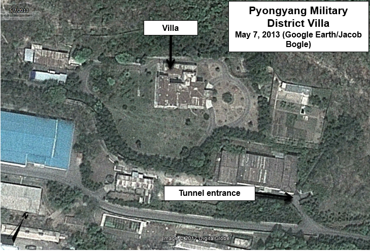
Google Earth/DigitalGlobe image clearly showing the tunnel entrance and villa. Dated May 7, 2013.
Based on satellite imagery, the heliport and associated buildings was under construction in June 2000 and was completed by November 2000.
Here is a Google Earth image from June 12, 2000 showing the construction process.

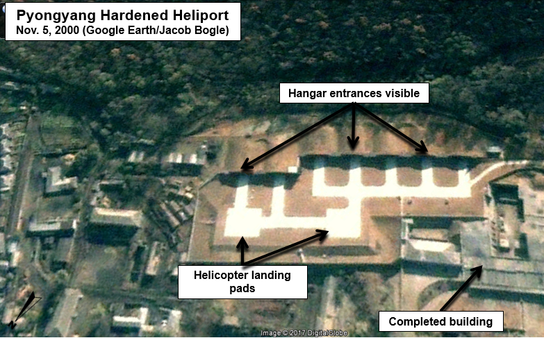
This one shows the completed work on Nov. 5, 2000.
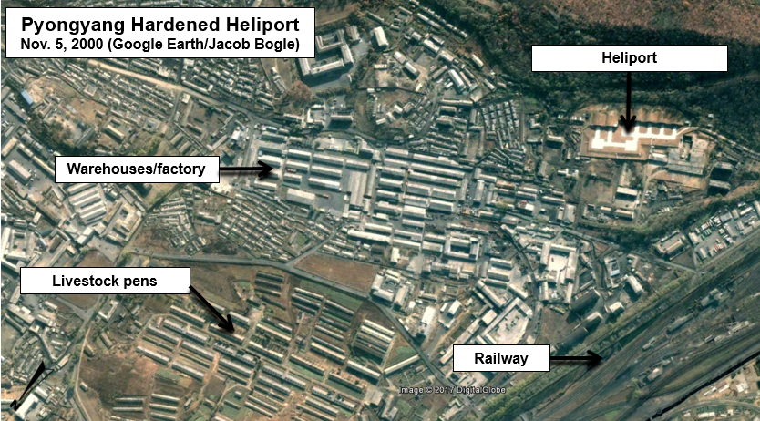
The area surrounding the heliport also underwent drastic changes over a number of years. Below is an image of the area on Nov. 5, 2000.
After several years of work, the area had been completely changed. Most of the work was completed by the end of 2006.

More recent activity was seen in 2013, when one of the hardened hangars was demolished following what appears to have been a collapse. The apparent collapse occurred at the start of 2013 and the cleanup work seems to have been completed by the end of the year.

While helicopters haven't been seen in any public access satellite images, the protective hangar doors have been seen opened in several images. One such time was May 10, 2016.

In September 2016, what looks to be the scorch marks from a fire or explosion can be seen on the left landing pad. On the Google Earth image dated Aug. 27, 2016, an unidentified object or mound of material can be seen on the landing pad. By the Sept. 23 image, a large blackened area can be seen, indicative of a fire or explosion.
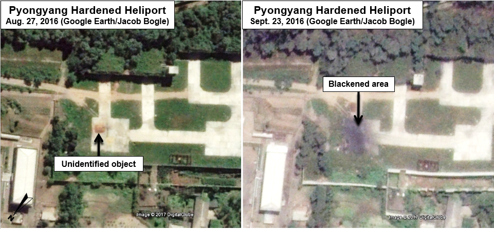
While I don't know if the object/mound in the first image is actually related to the explosion, the fact it was there soon before is worth mentioning. The burnt area hasn't been repaired as of April 22, 2017.
Trying to figure out where Kim Jong-un could go without knowing what kind of helicopters are available here is a bit of a guessing game, but if we assume they're one of the known helicopter types North Korea has (such as the Mi-8 Hip, or Mi-2 Hoplite), he could easily reach 270-300 miles (434-482 km) before needing to refuel. That range places nearly every other airport, palace, and key military base in North Korea within reach. It would also enable an emergency flight to China.
What exactly goes on at this site or where Kim Jong-un could ultimately end up if he had to flee can only be a matter of speculation (for now), but it's obvious the regime has taken great steps over the years toward protecting itself.
--Jacob Bogle, May 24, 2017
JacobBogle.com
Facebook.com/JacobBogle
Twitter.com/JacobBogle
Additional Reading
1. Report: US has mapped North Korean underground escape facilities (Aug. 5, 2015, Stars and Stripes)
No comments:
Post a Comment