Showing posts with label map. Show all posts

Sunday, February 26, 2023

AccessDPRK Free Map Update 1.1


Two years I ago I published the largest freely available map on North Korea ever created. After creating maps for a decade, I didn't want to keep re-mapping the whole country over and over. However, North Korea isn't static and things change over time.

So while I haven't made a completely new version, I have updated the original 2021 free map to reflect some of those changes.

Everything I do is done with Google Earth because it's the most accessible and user friendly program out there, and I want people to be able to explore North Korea without needing special skills or having to buy incredibly expensive software. 

One of the biggest changes to the map that's included in this update is due to the fact that Google Earth updated their own map of North Korea's administrative boundaries to more accurately reflect them. This is important because AccessDPRK maps are organized by province. 

As a result of the changes, around 800 places that had been in Pyongyang now show up as being in different provinces (because they are). So I have gone through and moved all of those military, economic, and other sites out of the Pyongyang folders and into the folders of their "new" provinces. 

I also reviewed all of the anti-aircraft artillery batteries as part of an article I wrote last year and updated nearly 100 sites to give users the most up-to-date look at all of the active AAA locations. 

Other changes include redrawn fences of the DMZ as small sections have been moved around/rebuilt, and to take into account the "drift" that happens when new satellite imagery is added that can cause placemarks and the objects they're marking to appear slightly out of line. So now everything lines up better to reflect current imagery.

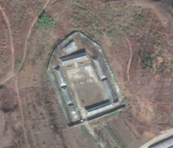
I have added additional gun emplacements in the DMZ, around 20 new "children's driving parks", updated all of the coastal fences, and made several other additions, corrections (like typos), added names to more sites, and made other small changes throughout. 

You can download this free file here

The file name is AccessDPRK_2021 Free Version-1.1 (2.2023) and it is 4.8 MB in size and contains over 61,400 items.

I am also in the process of doing a full update of the Pro Version and will hopefully be able to publish it later this year.


I would like to thank my current Patreon supporters who help make all of this possible: Alex Kleinman, Amanda Oh, Donald Pierce, Dylan D, GreatPoppo, Jonathan J, Joel Parish, John Pike, JuneBug, Kbechs87, Russ Johnson, and Squadfan.

--Jacob Bogle, 2/26/2023

Monday, February 1, 2021

AccessDPRK 2021 Map - Free Version

This image is an example of the domestic sites using the real icons in the map.

I started mapping North Korea in late 2012, released the first completed map in 2017, and began to remap the whole country in 2018. I wanted to keep track of changes, fix any old mistakes I came across, and to look for things that may have been missed during the initial phases of the project.

The combined result of roughly 7,000 hours of work is this 2021 free version. It contains over 61,000 places that are divided into three main categories: monuments, military, and domestic. Those are further broken down by province to give a more granular look at the country.

During the remapping process, I came across hundreds of places that had been mapped in 2017 but now no longer exist (mostly things like propaganda and town signs), so the true difference between the 2017 and 2021 versions comes to about an extra 8,500 places. Additionally, there were some categorization changes, new descriptions for hundreds of locations, and other changes. 

This Google Earth map is the most comprehensive look at the country freely available to the public. With some variation, there are 38-40 individual item categories in the domestic and economic section (everything from mining locations to irrigation pumping stations to factories and museums, schools and border security), and there are around 20 item categories in the military section. This has air defense sites, military bases, storage facilities, radar sites, etc. 

The monument's section is divided into Towers of Eternal Life and "others". Those include everything from murals to "On the Spot Guidance" memorials and everything else.

There is also a "nationwide" folder that is not divided into provinces but that holds all of the same type of place within single nationwide folders. The places in this section are: Historic Sites, DPRK Missile Bases, Prisons, Children's Traffic Parks, and Border Crossings (current and former). 

A note on the process of making this. As I have mentioned in previous blog posts, this project has been created by myself. I have no staff and no regular financial backing other than my great Patreon supporters. I have used what public information I could find in a reasonable amount of time (I can't read everything that comes out about the country), as well as my own experience to build this database.

I drew from older databases, books, government reports, western media, official North Korea media, think tank papers, conversations with knowledgeable people, and even sites like Wikipedia to help create it.

It is based on open-source information and geared toward English language readers. The Free and Pro versions have different levels of sourcing, but I almost exclusively stuck to English websites if I felt a location needed a link for reference. That means lots of places don't have links and many others don't need one at all.

For example, this is an anti-aircraft artillery battery. There is no need for some declassified document giving out the coordinates for this individual place. It is what it is, and there's around 1,500 of them.


As I said, not every place with a name will have a link. But for every place that does have a non-generic name, that name came from a source. Some of the locations were marked years ago, some were only marked within the last few months. Some online sources no longer exist, others have been archived. And other additional online sources may well exist, but if I don't know of them, I obviously can't add them.

I am not aware of any major, public database on North Korea that provides a citation for every single site (not even in cases when they're named and given other details). Sometimes the information comes from private discussions with defectors, other times it's drawn from old documentaries or DPRK media that no longer exists online (YouTube has conducted multiple purges of videos from official sources). In the process of creating this, I relied on established and trusted sources. 

If multiple sources say there's a missile base near Anbyon but with no specific coordinates, and I find a site with several indicators suggesting a site near Anbyon is a missile base, then that place will be marked as a potential missile base. If a building looks exactly like other known buildings, then it's going to get identified as that type of building (primary schools are a great example of this). 

This is a good faith, open-source project. Nothing more, nothing less. And out of over 61,000 places, errors probably exist. I do not guarantee that it is inerrant. Indeed, honest mistakes popup all the time, everywhere. I am trying to add to the world's available knowledge of the country and to seek the input and cooperation of others in filling in any holes or fixing mistakes. If you have any specific questions, feel free to ask.


Free Version Download & Operation

Here is the direct download link (version 1.1, 2023). The file is hosted via Google and is a little less than 5 MB in size. A new page will open and all you have to do is click the download button.

Simplified download screen. Yours may look different based on your browser.

If you're not familiar with Google Earth, it's pretty simple. Once you download the file, all you have to do is expand the menu (the little right-side arrows) to show the main sections. Pick one and expand it, decide which province you want to look at and expand that folder, and then pick the item(s) categories you're interested in. If you want to look at all of a particular site for the whole country, just click on each of the files within the various provinces.


Pro Version

If you're interested in the Pro Version, this page has a lot more information. In short, it contains nearly 9,100 additional places and over 3,000 other sites have extra bits of information such as links, construction dates, purposes and capacities, etc. 

For those interested in professional research or commercial/media interests, the Pro Version may be right for your needs.


Copyright Information

Aspects within the Free and Pro versions of the file may be subject to copyright and intellectual property rights enforcement under United States' law. No part of either version of the file may be used for commercial purposes without the express written permission of Jacob Bogle. This includes but is not limited to: use in contract bidding or fulfilling contracts for private or government interests; use in creating articles, films, maps, graphics, or other content for a profit-based entity; the creation of any map, dataset, or GIS product on a website or app that requires paid access to use that website or app. 


UPDATE: I have added an updated version, v1.1 (2023) in February 2023. It contains a number of changes to reflect provincial border adjustments, the addition of some new places, and corrected typos. The above download link is for the updated map. For more specific information, see here.


I would like to thank my current Patreon supporters for their continued support: Amanda O., Anders O., GreatPoppo, Joel Parish, John Pike, Kbechs87, Planefag, and Russ Johnson.

Thursday, November 2, 2017

Is North Korea's Prison System Far Larger than Expected?

By now, nearly everyone in the Western world has heard about North Korea's collection of massive prison camps. There are at least 35 jails and concentration camps in the country (including annexes), all holding around 200,000 prisoners. However, there are estimates that there may be another 10 re-education camps and there are other smaller prisons as well.

Locations of North Korea's main prison camps.

An October 2017 report by The Committee for Human Rights in North Korea (HRNK) titled, The Parallel Gulag, details a system of prisons that operate through the Ministry of People's Security and are called "an-jeon-bu". The report focuses on 22 possible sites. But something that really caught my eye was the design of these sites.

Within the #AccessDPRK Map are hundreds of "compounds". These are generally unspecified groups of buildings or walled-off compounds. I didn't know what they were for certain, but they occurred with such regularity that I felt it was important to map as many as I could. They could be small factories, perhaps barracks or police stations, food distribution centers, or even jails. The places within the "compound" classification vary widely in their configurations, but a good many seemed to follow the same basic design.

In the 2017 report The Parallel Gulag, HRNK discusses a separate, parallel prison system apart from the country's wider known system of massive concentration camps. The report details 20 sites and all share similar design characteristics between each other and the hundreds of other compounds that were mapped as part of #AccessDPRK.

Here are a few satellite images of sites discussed in The Parallel Gulag.


The site above was identified by HRNK as Kyo-hwa-so No. 2 and is located at 39°52'5.88"N 124°44'59.48"E near Tongrim, North Pyongan Province.


The site above was identified by HRNK as Kyo-hwa-so No. 88 and is located at  39°11'58.80"N 127°20'44.93"E between Munchon and Wonsan.


And this site was identified by HRNK as a likely jail in Sangtong-ri (40° 5'35.61"N 127°21'26.26"E) in South Hamgyong Province.

This next set of Google Earth images show a few of the "compounds" that were mapped as part of #AccessDPRK.


This is a site in Kangwon Province and is located at 39°13'41.87"N 127°20'22.79"E


Back in April 2017, I took to Twitter and asked people what they thought these places were. I received several suggestions, but most said they were probably associated with agriculture or food distribution. And we do know that grain warehouses and distribution points are well guarded, which would necessitate walls and guard posts. However, defector testimony has also revealed that during the famine many places were set up as detention centers to handle the huge number of orphaned children. The government simply took over any available buildings it needed and converted them to this use. They were described as little better than prisons in terms of design and security.
If you have no food but need secure buildings, former food distribution centers may have filled the role. Of course, how long the regime continued to use them for this purpose, or if they were changed to serve as another type of detention center isn't known.

With the publication of The Parallel Gulag, we can now definitively say that North Korea's system of concentration and labor camps, prisons, and local detention facilities is much larger than many realized. Considering I knew of so many similar facilities throughout the country, I reached out to North Korea analyst Joseph S. Bermudez (who also aided in the analysis of satellite imagery for the HRNK report). I gave him a few examples of the sites I had mapped, and he gave me his opinion on each one. As with Twitter, he, too, said they were a mix of detention facilities, barracks for local military/paramilitary units, and agricultural related facilities. However, he also said that a lot more study needed to be done.

Map showing the additional sites of interest.

Without further study and defector testimony, we may never know precisely what each of these locations are. However, I have located 632 such sites all over North Korea, which would mean there is a full order of magnitude more of these sites than fully functional hospitals in the whole of the country. With stories of "orphan jails", the now revealed parallel system of jails, the knowledge of historical "black sites" (like The Barn), and the highly secretive nature of the regime, it is safe to bet that at least some of these facilities are previously unknown prisons.

Here is a map of all the sites. If you open it up in Google Maps, you can save it as a KML for Google Earth as well.


If you have any additional information on any of these sites, please let me know!

--Jacob Bogle, 11/2/17 (updated 5/10/2019)
JacobBogle.com
Facebook.com/JacobBogle
Twitter.com/JacobBogle

Tuesday, July 4, 2017

North Korea by the Numbers


Phase II of the #AccessDPRK Mapping Project was published on March 5, 2017, but simply knowing where everything is doesn't make understanding the full picture much easier - especially when considering there's over 50,000 places marked. So I've put together these basic charts showing the total number of items per division (monuments, military, and domestic), the total items per province, and the total number of items within each type mapped (AAA sites, elite compounds, dams, communication centers, schools, etc.).

I'd like to point out that the overall figures here will differ slightly form the ones listed in the March 5th publication article. All told, there are some 600 individual sub-folders I have to keep track of and the resulting numbers take up 24 pages; minor mistakes happen. A couple numbers were inverted, and a few others were slightly off, however the overall discrepancies are very minor when compared with the whole. After making those needed corrections, the information below should be considered as authoritative as it will get with regards to the project.

The following charts (monuments, military, and domestic) represents the most detailed map of North Korea ever released to the public.


Many monuments are clustered closely together, making marking each one individually impractical. Instead, some markers are placed next to a group of monuments (2-4 generally), so while Pyongyang may have 1,049 markers on the map, those markers represent 1,230 individual monuments.

It's important to note, for those unfamiliar with the project, that the numbers below represent the numbers within the various folders by those names. There will be some items where there will only be one or two places within a province - those didn't necessitate their own folders. In such cases, they're often located in the "un-categorized" folder. An example of this is military training centers and military factories. Just about every province has at least one, but only a few have a folder dedicated to them.  A similar situation exists within the domestic file; bunkers, water towers, jails, and others may or may not have their own folder, but they will all be mapped.


While the purpose of this project is to map every one of a particular item, there are some items that I did not intend on mapping each and every one of, such as "firing positions". These trenches and prepared (but empty) gun positions cover the country and number in the thousands. In many cases it's also difficult to determine whether or not something was just a leftover temporary fortification from the Korean War or is part of the country's current defense structure (which does include having trenches in just about every available space). Additionally, the "radar" count is predominantly stand-alone radar sites, not the numerous smaller radars that accompany permanent artillery positions; although some of those are mapped as well. "Gates" are only mapped when they help define the boundaries of an area or are large - there's no real need to map every single gate at every single military site.

With the exception of a few items: canals, signs, factories and farming (to a degree), mountaintop sites, gates, and water supply, I have tried to be as comprehensive as possible in mapping each and every one of the other sites. Regarding the number of factories and farming/agricultural facilities, I focused on only mapping the larger sites, while also mapping some smaller agricultural facilities (like wheat threshing sites) to provide examples of what those numerous places look like. 

In short, the map contains 8,865 monument markers (representing 9,896 individual monuments), 9,594 military sites, and 35,252 domestic and economic sites for a total of 53,711 placemarks. There are also hundreds of fences and other things outlined in the map, but those aren't included in the counts as the places fenced in have already been accounted for.

#AccessDPRK will occasionally be updated to provide greater accuracy as new information comes in, fixing any unintentional errors, and adding more details.


--Jacob Bogle 7/4/17
JacobBogle.com
Facebook.com/JacobBogle
Twitter.com/JacobBogle

Sunday, March 5, 2017

Phase II Map Completed


One year ago today I published Phase I of my #AccessDPRK Mapping Project. I began mapping North Korea in late 2012, little did I know how much of an effort it would take or how expansive a map would result from the over 2,500 hours of work. I won't recount why I started, you can read more about that here, but I do want to stress that this map has become the largest and most comprehensive map of North Korea publicly available, by far.

The Google Earth file contains 53,722 placemarks covering three main areas of interest: the military, monuments, and domestic/economic sites. There are 9,567 military sites, 8,859 monument markers representing 9,879 individual monuments, and 35,296 domestic sites. Because I started mapping after I discovered Curtis Melvin's map and because I updated and incorporated his North Korea Uncovered into mine, I would like to say that of the 53,722 places, 8,430 of them came from North Korea Uncovered.

The file is divided according to each province and each province is divided into those three main areas (some have an extra division). Those three divisions are further sub-divided into item-specific folders (anti-aircraft artillery, dams, palaces, etc.). Typically, the military division has around 20 folders and the domestic division has around 40. The monument division is just a single folder containing all of the monuments in its respective province. There is also an "Additional Items" folder that has things like all the country's airports and a list of mountains. And, there is a file dedicated to the De-Militarized Zone with 1,401 places marked.

Because of the size of the KMZ file (4.76 MB - which is huge by Google Earth terms), don't try to view the whole thing at once. Expand the file and pick out which province you'd like to review and then what item folders you want. There are many ways to explore the information within, just take a little time to get used to the layout so you don't accidentally crash Google Earth (although, most modern computers can handle having the entire file open, it may be sluggish).

The next part of #AccessDPRK is to create a series of topic-specific files. For example, the country's electrical grid. This will allow those with narrower interests to view the information they want without the need to dig through mountains of data. However, there is no firm time set for me to build and publish those maps. After working on this for so long, I'm in the mood to take things more slowly now.

Map showing every monument in North Korea. Click for larger view (opens in new window).

[Note: the download link to the 2017 map has been removed as the 2021 version was made available.]

Below is a breakdown of the number of items per province and other main folders. As soon as I can I will also add some graphics showing how many of each item there are (like the fact there's active 1,539 anti-aircraft artillery batteries).


Phase II Complete Item Counts - March 5, 2017

Chagang Province = 2,695
   Military: 162
   Monument: 544 markers rep. 585 monuments
   Domestic: 1,989

Kangwon Province = 4,443
   Military: 1,131
   Monument: 762 markers rep. 928 monuments
   Domestic: 2,550

N. Hamgyong Province = 4,690
   Military: 450
   Monument: 765 markers rep. 796 monuments
   Domestic: 3,475

S. Hamgyong Province = 6,300
   Military: 627
   Monument: 1,053 markers rep. 1,154 monuments
   Domestic: 4,620

N. Hwanghae Province = 5,833
   Military: 1,347
   Monument: 946 markers rep. 1,100 monuments
   Domestic: 3,540

S. Hwanghae Province = 6,304
   Military: 1,008
   Monument: 1,054 markers rep. 1,146 monuments
   Domestic: 4,242

N. Pyongan Province = 5,581
   Military: 716
   Monument: 1,049 markers rep. 1,145 monuments
   Domestic: 3,816

S. Pyongan Province = 7,002
   Military: 1,134
   Monument: 1,205 markers rep. 1,325 monuments
   Domestic: 4,663

Pyongyang District = 6,150
   Military: 1,129
   Monument: 1,049 markers rep. 1,230 monuments
   Water supply: 290
   Domestic: 3,682

Rason District = 531
   Military: 42
   Monument: 94 markers rep. 99 monuments
   Domestic: 395

Ryanggang Province = 2,183 total
   Military: 95
   Monument: 338 markers rep. 371 monuments
   Domestic: 1,626
   Mt. Paektu: 126 - inc. 2 duplicates not inc. in counts elsewhere

DMZ-area Road Blocks: 198
DMZ: 1,401 + 394 miles of fence
Tall Mountains: 245
Airports: 127 (108 runways and 19 waypoints)
UN Joint Security Area: 5
Border Crossings: 24
Large intersections: 10


**********Grand Totals**********
Grand Total: 53,722 markers
   Military: 8,201 + DMZ/RBs/Airports = 9,567
   Monuments: 8,859 markers representing 9,879 monuments
   Domestic (inc. Border/Intersections/Mts) = 35,296


NOTE: AccessDPRK maps, articles, or other creations may not be used for commercial purposes without the express authorization of Jacob Bogle.


--Jacob Bogle, 3/5/17
www.JacobBogle.com
Facebook.com/JacobBogle
Twitter.com/JacobBogle

Saturday, March 2, 2013

Update 2 + Sightseeing

I now have files started on all provinces, expanded my file on the DMZ and creating a new folder to deal solely with road blocks in and around the DMZ.

I've also re-organized each file to make them easier to use once they're published. Originally I simply had 3-4 categories for each area but that meant they were enormous and if someone only wanted to view train stations they would have had to un-click all the other placemarks. When I began, I had no idea just how many places would need to be marked. So now the main categories for all files are: Military, Monuments and Domestic but they each will have sub-categories, although there may be some differences dependent on the region.

Sub-categories will usually include:
Domestic - Irrigation & Dams, Road & Rail tunnels, Sub-stations, Fishing villages, Town signs, Burial mounds, Compounds, Road Blocks, Unidentified/Unknown items
Military - Coastal positions, AAA sites, Bunkers/Storage
Monuments will not have any sub-categories.

Also, I did a full count and to-date I have marked over 3,260 new places.

Now, let's have a bit of fun and do some sightseeing. As always, simply click on an image to enlarge it.

First there's this naturally made island in the northwest which looks remarkably similar to the real Korean Peninsula.


I wasn't the first person to find this island which would normally mean I wouldn't post it but I find it most intriguing and thought you would as well. Similarly, some of the other locations in this post have been known about for years but they're still interesting and we're "sightseeing" anyways.

Here's an example of the ~3,200 "Towers of Eternal Life" which were erected in every town and village after the death of Kim Il-sung.[1]


This is another monument. Well, actually there are two, the tower (right) and what is most probably a mural (center) of either Kim Il-sung or Kim Jong-il.


Here is one of the few working factories in the country.


Based on close-up imagery the factory looks like it was much larger in the past and as the North Korean economy flat-lined many of the buildings were torn down or fell into disrepair. There is still evidence of some production going on given the dark smudges on the undamaged roofs caused by pollution.

This image shows a large communications tower and shadow.


Korean's (both north and south) are traditionally a Confucian society. Part of that entails burial mounds instead of the below ground burials common to Western culture.[2] Here is an example of one such mound.


It is impossible to tell how old this mound is, but it is likely the person who died was either wealthy or an important figure in the region the mound is located in. During the famine, also known as the Arduous March, the bulk of the 1 million+ dead were buried in mass graves or in smaller, irregularly shaped burial mounds. These can be seen on almost every hill in the country. I suppose this mound could have been built for an important person who died during the famine, but again, it's impossible to tell.


This is Sariwon, the capital of North Hwanghae Province. From space, at least, the city looks nicely maintained, has a well laid out street plan and would be a nice place to live. It has a population of over 300,000. The park located slightly off center-left contains a very large statue of Kim Il-sung.

Finally, we have a vast vacation compound in the port city of Wonsan.


I have zoomed in on Kim Jong-il's villa.[3] The grounds contain a number of large homes (you can see two of them on the right side) which are for government officials and guests. The two largest homes both belonged to Kim Jong-il. When he died Kim Jong-un demolished a number of his father's homes but so far this one has remained intact and will likely be used for years to come.


Sources:
1. North Korea's Cult of Personality, Wikipedia
2. Traditional Korean burial mounds, NK Economy Watch
3. Kim Jong-il staying at villa, Daily NK


--Jacob Bogle, 3/2/2013
www.JacobBogle.com
Facebook.com/JacobBogle
Twitter.com/JacobBogle

Sunday, February 24, 2013

Mapping Project Update 1

In 2005 Mike Ane started a file containing several hundred locations of interest and then in 2007 Curtis Melvin and his associates at www.NKeconWatch.com greatly expanded the file by mapping the economic, cultural and military sites of North Korea using Google Earth. Their work brought to light thousands of locations and their KMZ file has been downloaded well over 151,000 times. However, as I would look over the country, I would spot something they had missed, and then it dawned on me that no private citizen (to my knowledge) has ever gone through the whole of North Korea, literally square mile by square mile, and marked every single item of interest.

So, a few months ago, I decided to take on that challenge. The work of Curtis and another avid GE user ( "Planeman_") laid the foundation and their descriptions taught me a lot about what places look like. For example, what an anti-aircraft artillery site looks like from aerial imagery, what an electric sub-station looks like, monuments, train stations and so forth. Building on that knowledge and what I have learned through hundreds of hours of research, I have been able to mark thousands of new places without duplicating the findings of others. 

This has been and continues to be a tremendous undertaking, but I think it is very important to shed light on a country so few know anything about. Even since Google Maps began, there was always a black hole in their data - North Korea - and it wasn't until a few weeks ago that Google began filling in the blanks, largely thanks to the work of individuals submitting information. It is my hope that in time North Korea opens up as a country, but until that time comes, I consider it worthwhile to use technology to reach out from my computer to data gathered from space and pull North Korea (or at least what I find) out of the void and bring it to the world. 

North Korea is divided into 9 provinces, 2 special cities, and the capital district. There is also the DMZ (Demilitarized Zone) which I count as its own geographic division. Each area has its own file which is then subdivided in categories: Military, Monuments and Domestic. Each category may have further sub-categories such as: Sub-stations, Irrigation control and Dams, AAA sites, Road & Rail Tunnels etc. I have been making use of the placemark icons and try to make them self-explanatory and use one icon for each different type of location to avoid confusion.  

The image below is a screenshot of all the places I've marked (excluding completed areas). Obviously, it looks like a mess and you're only seeing a handful of individual sites since they're all piled on top of each other, but I think it gives you some idea of what I've been doing and talking about for so long. 

(click for larger)

I have started files on almost every area and completed the DMZ, the Rason Special City and Ryanggang Province. It is my intention to publish the files once I am closer to completing the project, although I may publish what areas I've finished sooner. 

With completed divisions and the portions of partially completed divisions combined, I estimate that I am 25% finished and have marked roughly 2,200 items. The completed areas cover nearly 6,000 sq miles of territory out of NK's total land area of 46,541 sq miles. Due to the lower quality of some of the data there will be portions that have very few placemarks simply because the resolution is so low that specific individual items can't always be identified.

--Jacob Bogle, 2/24/13
www.JacobBogle.com
Facebook.com/JacobBogle
Twitter.com/JacobBogle

You can use the hashtag #AccessDPRK when discussing on social media.