Showing posts with label Pyongyang. Show all posts

Monday, December 25, 2017

Pyongyang's Thirty Years of Growth

Image of Mirae Scientists Street along the Taedong River. (Image Source: Rodong Sinmun.)


Like any national capital, Pyongyang is a dynamic and growing city whose fortunes rise and ebb as the fortunes of domestic and international affairs fluctuate. Pyongyang was founded in 1122 BC (according to legend) and served as one of the capitals of ancient Korean kingdoms. Over the course of the Korean War, the city - like much of the peninsula - was completely destroyed. Kim Il Sung spent enormous resources rebuilding the nation and redesigning Pyongyang into a showcase capital.
The attempt to use the capital to project power and showcase the miracles of socialism resulted in massive 'people's palaces' and numerous monuments, and peaked with the construction of the Ryugyong Hotel. Construction of the hotel, which was to be the tallest hotel in the world, was halted in 1992 (it still sits unfinished to this day). The fall of the Communist Bloc between 1989-1991 and the following famine of 1994-1998 resulted in the near total collapse of the North Korean economy.

Pyongyang itself suffered stagnation and large swathes of the city degraded. In the early 2000s, as gray and black markets began to rise, so too rose the fortunes of Pyongyang and the government has since embarked on a modernization program. The process was relatively slow under Kim Jong Il, but Kim Jong Un has overseen one of the largest building booms in North Korea's history.

One good and simple measure of the growth and strength of a city is population, unfortunately, population statistics are considered a state secret in North Korea, so getting accurate figures can be difficult - especially when you consider the widely varying figures concerning the number of deaths during the famine and the fact that there have only been two national censuses since 1980. Fortunately, the use of satellite information can help fill in some of the gaps by showing which areas have undergone urban growth. Contrary to what one may expect, despite all of North Korea's economic problems and the vast sums spent on military projects, the change in Pyongyang over the past 30 years is pretty astounding. A resident from 30 years ago would scarcely recognize the Pyongyang of today.


Thanks to Google Earth, historical Landsat and Copernicus satellite imagery dating as far back as 1984 is now easily available and covers most of the planet. Using this resource one can see the growth of cities and the spread of human development; an asset for studying a large number of topics. The outlines in the images below are densely populated urban areas that are contiguous within the outlined area. In other words, if there are two urban spaces separated by a large area of forest or farmland, they won't be included within the same outline.

In 1984, Pyongyang had an urban area of approximately 70.2 square miles (+/- 1 sq. mi) and by 2017, Pyongyang's urban area had grown to 103 square miles (+/- 1.5 sq. mi). At this point it's important to make the distinction between the capital region of Pyongyang and the core city of Pyongyang proper. The Pyongyang region is 1,233 square miles and has a population of over 2.5 million. However, within the region are 19 wards and two counties, and within all of those are dozens of smaller towns and villages. One of the larger areas within the region is Kangdong, which has a population of 221,000 and is around 20 miles away from downtown Pyongyang. So when considering population and population density of Pyongyang proper, it's necessary to exclude the populations of these satellite areas.

Here is a map showing the nine largest urban/industrial areas within the Pyongyang capital region as of 2017.


Outside of the city of Pyongyang and the growth of the airport, little has changed in the expansion of other urban areas with the exception of the city of Sangwon, which largely grew up as the Sangwon mine was established and the cement complex opened (in 1989).

To determine the land area of urban spaces, I outlined the areas and cut them into easily measurable geometric shapes. The white area is Pyongyang's main urban coverage in 1984, and the yellow represents 2017. It required over 200 individual measurements. You may find some areas that look like irregularities (yellow lines inside of white areas), and that's due to the fact that the image resolution for 1984 is much lower than that of 2017, making the 1984 area slightly less precise. I have tried to correct for this.


Beyond the simple growth of urban boundaries, the density of buildings has also changed drastically, particularly in a few key areas of the city. The change in total area of Pyongyang from 70 to 103 square miles is a comparatively slow growth rate when you look at other major world cities. Even my own medium-sized town has doubled in land area over the last 30 years. One reason for this limited growth is, of course, that residency in the capital is tightly controlled and has tended to stay at 10% of the national population. Another reason is the fact that there is no private land or home ownership (officially), so there aren't the endless subdivisions of single-family houses as seen in the US and other countries.

Pyongyang in 1984 showing some of the major areas of future construction. The Mansu Street area is already under development by this time. Image based on Google Earth and Landsat/Copernicus. 

Because of those facts, most residential units are in apartment complexes and single-story multi-family houses. There are three areas that really stand out to me as seeing the most growth and change over time: Ryomyong Street (which recently was 'opened'), Mirae Scientists Street, and the Tongil Street area which has been growing for the entire 30-year period.  A quick comparison of satellite images from 1984 (above) and 2017 (below) clearly shows the expansion of these and other areas, but I will only go into detail for the three I mentioned.

Pyongyang in 2017. You can see the large amount of development in the Tongil and Kwangbok regions as well as other changes such as the construction of the Ryungyong Hotel, the expansion of the Palace of the Sun, and the May Day Stadium which was built in 1989.

I'll begin with Tongil.
Tongil Street is a major road that runs east to west on the southern side of the Taedong River. Planning for the construction of the street (and associated buildings) began in the early 1980s along with several other smaller "street projects" like An San Taek, Munsu, Kwangbok, and Yanggwang streets. However, Tongil didn't see much real construction until 1991 when a speed campaign turned the area from farmland into a booming work site.

The Tongil Street area in 2017. 

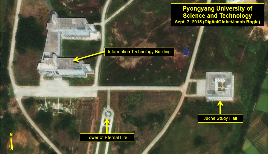
As you can see in the 1984 image of Pyongyang, nothing existed in this area at the time. Since construction first began in the 1990s, Tongil Street has undergone almost continual growth. Other areas have also grown out from Tongil and now include the Pyongyang University of Science and Technology (PUST), Chollima Building Materials Factory, and the Pyongyang Catfish Farm.


Google Earth image of Mirae Street on May 10, 2001.

The next street is Mirae. Mirae runs along the northern bank of the Taedong River, across from Yanggak Island. "Mirae Scientists Street" was developed to house faculty and their families as well as various institutions of the Kim Chaek University of Technology. The development included over 2,500 apartments and boasts one of the tallest buildings in Pyongyang, the 53-story Mirae Unha Tower. However, many of the apartments on higher floors of the various buildings remain uninhabited due to a lack of electricity to power elevators and heating units, despite being completed in 2015. Additionally, the development came after a 23-story apartment building collapsed, killing dozens of people. These two factors have likely played a role in the slow pace of occupancy.

This brings me to a larger issue that plagues North Korea. The country has relied on Stakhanovite mass-mobilization speed campaigns (like the Chollima Movement) to construct large projects at a neck-break pace. From hydroelectric dams to large buildings, the government forces their completion within a year or two at most (if they get their way) when in reality, these things should take upwards of 5 or 10 years to be done safely. While Pyongyang may now be bustling with rather striking looking and shiny new buildings, the soundness of their construction and long-term safety is deeply questioned.

Google Earth image of Mirae Street on May 1, 2012. You can see some apartment buildings have been built since 2001.

Modern Mirae Scientists Street, also nicknamed "Pyonghattan".


The last major development I am going to focus on is Ryomyong Street, which was only opened in April 2017. Running roughly southwest to northeast, the street connects the 15 April House of Culture and the 92-meter (302 foot) tall Tower of Immortality with Kim Il Sung University and the enormous Palace of the Sun, which now serves as a billion dollar mausoleum for Kim Il Sung and Kim Jong Il's bodies. The new towers offer thousands of additional housing units.

The bright buildings of Ryomyong Street at night along with the newly renovated Tower of Immortality. (Image Source: ExploreDPRK.com)

Kim Jong Un ordered the construction of the area's redevelopment in March 2016, meaning the multiple residential buildings (including one that has 70 floors), stores, and restaurants were all completed in less than 13 months - which again calls into question the quality and safety of the buildings. There is a second phase of the project, which is still ongoing, that is expanding Kim Il Sung University and constructing new housing further up the street. Funding for the "200 day speed battle" to build the area came (at least in part) from the government's demand that families hand over $50 to pay for it. While $50 may not sound like much to us in the West, it's enough to purchase 80 kg (176 pounds) of rice on the market. It's also the approximate equivalent of 2 weeks' pay. These funds are on top of a seemingly never-ending demand for "loyalty payments" and other fees citizens are required to regularly come up with.


There has also been inevitable change to the more rural areas of Pyongyang. Multiple small villages have been demolished and rebuilt along more efficient lines. Not only does this help with local housing shortages and the badly needed replacement of dilapidated homes, but the greater efficiency of the layout results in more usable farm land in the aggregate, even if it's just a few added acres here and there.

Some of the rural areas with newer housing.

Here is a close-up example of the demolishing of a small village, with its older housing and more haphazard layout, and at the same time, the construction of modern houses in another village about a kilometer northeast.

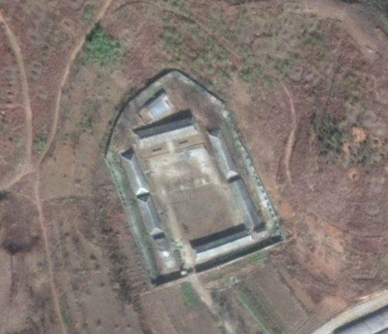
Unnamed village in Pyongyang that was demolished in 2017.


Finally, here's a map showing many of the areas of Pyongyang that have experienced major new construction or redevelopment since 2009 (includes some industrial areas). I chose 2009 because that was the first year after Kim Jong Il's stroke and the year Kim Jong Un officially began to be groomed to take over for his father.


Pyongyang, like the rest of the country, continues to grow despite sanctions or the highly unstable and wasteful model of having parallel military and domestic economies which has governed the country since the early days of Kim Il Sung. The rise of markets and an unofficial middle class means that there is more individual interest in living in nice apartments - and that there's money to go around to make construction happen. Additionally, Kim Jong Un is keen to make his mark in all areas of concern, with major construction projects being seen in every large city across the country. Kim III will undoubtedly go down in history as the man who brought North Korea's nuclear program to completion, but he will likely also be noted for spending billions on national construction; perhaps the largest builder since his grandfather. However, history will also mark whether or not all of the energy and wealth poured into these projects was worth it, or if it had no net positive effect on the people and only served to drain badly needed resources as the skyscrapers of Pyonghattan eventually collapsed one by one.

--Jacob Bogle, 12/25/2017
www.JacobBogle.com
Facebook.com/JacobBogle
Twitter.com/JacobBogle

Additional reading
1. 2008 DPRK Census Report (PDF)

Thursday, November 2, 2017

Is North Korea's Prison System Far Larger than Expected?

By now, nearly everyone in the Western world has heard about North Korea's collection of massive prison camps. There are at least 35 jails and concentration camps in the country (including annexes), all holding around 200,000 prisoners. However, there are estimates that there may be another 10 re-education camps and there are other smaller prisons as well.

Locations of North Korea's main prison camps.

An October 2017 report by The Committee for Human Rights in North Korea (HRNK) titled, The Parallel Gulag, details a system of prisons that operate through the Ministry of People's Security and are called "an-jeon-bu". The report focuses on 22 possible sites. But something that really caught my eye was the design of these sites.

Within the #AccessDPRK Map are hundreds of "compounds". These are generally unspecified groups of buildings or walled-off compounds. I didn't know what they were for certain, but they occurred with such regularity that I felt it was important to map as many as I could. They could be small factories, perhaps barracks or police stations, food distribution centers, or even jails. The places within the "compound" classification vary widely in their configurations, but a good many seemed to follow the same basic design.

In the 2017 report The Parallel Gulag, HRNK discusses a separate, parallel prison system apart from the country's wider known system of massive concentration camps. The report details 20 sites and all share similar design characteristics between each other and the hundreds of other compounds that were mapped as part of #AccessDPRK.

Here are a few satellite images of sites discussed in The Parallel Gulag.


The site above was identified by HRNK as Kyo-hwa-so No. 2 and is located at 39°52'5.88"N 124°44'59.48"E near Tongrim, North Pyongan Province.


The site above was identified by HRNK as Kyo-hwa-so No. 88 and is located at  39°11'58.80"N 127°20'44.93"E between Munchon and Wonsan.


And this site was identified by HRNK as a likely jail in Sangtong-ri (40° 5'35.61"N 127°21'26.26"E) in South Hamgyong Province.

This next set of Google Earth images show a few of the "compounds" that were mapped as part of #AccessDPRK.


This is a site in Kangwon Province and is located at 39°13'41.87"N 127°20'22.79"E


Back in April 2017, I took to Twitter and asked people what they thought these places were. I received several suggestions, but most said they were probably associated with agriculture or food distribution. And we do know that grain warehouses and distribution points are well guarded, which would necessitate walls and guard posts. However, defector testimony has also revealed that during the famine many places were set up as detention centers to handle the huge number of orphaned children. The government simply took over any available buildings it needed and converted them to this use. They were described as little better than prisons in terms of design and security.
If you have no food but need secure buildings, former food distribution centers may have filled the role. Of course, how long the regime continued to use them for this purpose, or if they were changed to serve as another type of detention center isn't known.

With the publication of The Parallel Gulag, we can now definitively say that North Korea's system of concentration and labor camps, prisons, and local detention facilities is much larger than many realized. Considering I knew of so many similar facilities throughout the country, I reached out to North Korea analyst Joseph S. Bermudez (who also aided in the analysis of satellite imagery for the HRNK report). I gave him a few examples of the sites I had mapped, and he gave me his opinion on each one. As with Twitter, he, too, said they were a mix of detention facilities, barracks for local military/paramilitary units, and agricultural related facilities. However, he also said that a lot more study needed to be done.

Map showing the additional sites of interest.

Without further study and defector testimony, we may never know precisely what each of these locations are. However, I have located 632 such sites all over North Korea, which would mean there is a full order of magnitude more of these sites than fully functional hospitals in the whole of the country. With stories of "orphan jails", the now revealed parallel system of jails, the knowledge of historical "black sites" (like The Barn), and the highly secretive nature of the regime, it is safe to bet that at least some of these facilities are previously unknown prisons.

Here is a map of all the sites. If you open it up in Google Maps, you can save it as a KML for Google Earth as well.


If you have any additional information on any of these sites, please let me know!

--Jacob Bogle, 11/2/17 (updated 5/10/2019)
JacobBogle.com
Facebook.com/JacobBogle
Twitter.com/JacobBogle

Friday, August 25, 2017

Kim Jong-un's Spy School Gets Upgrade

North Korean soldiers during an annual military parade.

One of North Korea's main espionage facilities, located in northern Pyongyang, is growing.

North Korea (with their several government agencies and branches of the military) has a long history of espionage and infiltrating South Korea. The DPRK also has one of the most active cyber warfare units in the world. Both the military and various agencies have a substantial amount of overlap.

According to defector Ahn Myung-jin, one of these facilities (which is near Kim Jong-il Political-Military Academy, also a spy school) is under the Strategic Division of the Central Party Espionage Department. The espionage training annex has a large underground facility with a tunnel 12 meters high, 30 meters wide, and 8 km long. It contains scale models of Seoul, important buildings like the Blue House, and even "functional" areas where officers can get used to going to shopping centers and using currency. The training period within the tunnel can last 15 days to a month each year.

As a reminder, clicking on the images will allow you to see larger versions.

This Google Earth image shows you the location of the espionage center (top) and surrounding points of interest.


Given its association with the Kim Jong-il Political-Military Academy, it is probable that this site is under the control of the General Reconnaissance Bureau, which is in turn controlled by the National Defense Commission (instead of the Korean Worker's Party which has its own intelligence agencies).


In this image from 2013, you can see the key areas of the center, including the underground tunnel entrance which also has an insert from another angle to allow you to see the actual opening. The two "areas of interest" are the main sites that will be changing.

On Nov. 9, 2015, commercial satellite imagery showed a building undergoing some type of alteration. The building had been emptied and the roof removed. It also shows that a collection of greenhouses near the main gate had been removed.


Fast forward to May 2016, and the first building mentioned above has been torn down to its foundations. A new building can be seen under construction as well.


The latest freely available commercial imagery is dated April 22, 2017. There is a lot of activity that can be seen.


The first buildings pointed out in earlier images are basically completed. However, there is new construction going on in two additional sites, plus a further building being torn down. The entrance gate is also undergoing some kind of an upgrade.

These changes will add at least 32,000 square feet (2,972 sq. m) of additional floor space. The site labeled "New Construction Site" is the location of an earlier building that has been demolished. If a new building is constructed and occupies the same footprint, that would modernize a further 39,000 sq. ft (3,623 m) of space.

To top it all off, the monuments are being changed, too. As I have written about extensively, monuments to the leaders (as part of the pervasive personality cult) are an integral piece of every military and civilian institution in the country.


The original monument was a group of 4 bronze figures, as seen above. The monument has existed since at least 2005. Sets of solar panels are also visible. These panels can first be seen in March 2016.

What is interesting is the lack of a central statue of Kim Il Sung (joined by statues of Kim Jong-il after his death in 2011). Nearly every major site in the country has such statues (to go along with murals and other smaller monuments).

It appears they've rectified this. On the April 22, 2017 image, the group of statues has been removed and now only spaces for two new ones are visible. This change also suggests, in my opinion, the elevation in importance of this complex.


In this image you can also see a close-up of some of the building construction going on. Near the statue place (which is on top of a mound) are piles of construction/landscape materials. The monument mound will be resurfaced with grass and other plants, the stone steps leading up to the statues themselves will be new, and it's likely the whole courtyard will be refaced with new stone.

The solar panels have been removed as well. It's probable they were only used to help power necessary construction equipment or needed lighting since a stable supply of electricity is still a problem, even in Pyongyang.

There are many examples of military locations being modernized, and various related construction projects are underway all over the country. While specifics are hard to come by for most of these places, what we can learn from satellite imagery is that large sums of money are being poured into defense (from the regular Army and Navy, to the Strategic Missile Forces and covert operations agencies). With this site in particular, we can see that an increased training capacity is being planned (as evidenced by the added square footage) and that the nation's leadership is keeping a close eye on the place, making its importance greater.

--Jacob Bogle, 8/25/17

Additional Reading
(38 North Special Report, by Joseph S. Bermudez, June 2010)

Saturday, July 15, 2017

The Price of the Cult of Kim

(To save and read for later, you can download the PDF here)

Figure 1: Visitors bowing before statues of Kim Il-sung and Kim Jong-il at the Mansu Hill Grand Monument. (Image credit: Commons/J.A. de Roo)

Summary

While state-directed personality cults are nothing new, the magnitude of the North Korean personality cult surrounding the ruling Kim family surpasses any other. The cult’s main foundations are structured around the thoughts and orders of the Kims. Having a large effect on the nation’s economy, culture, and military, the cult and its associated “Kimilsungism-Kimjongilism” (the revolutionary political and philosophical thought of Kim Il-sung and Kim Jong-il) has been described as the primary focus of the country and a central motivation behind the activities of the government. [1][2]

The amount of resources dedicated to the construction, maintenance, and expansion of the cult over its decades of existence has cost the country billions in direct and indirect costs. The funding apparatus of this system features heavily within the bureaucratic hierarchies and helps to “grease the wheels” when it comes to providing assets for military programs and large construction projects; ostensibly to enable the construction of a “strong and prosperous nation”. In a country where one man rules with an iron grip and in which no major decision can be made without him, the use of the cult (and its mix of nepotism and bribery) is essential to Kim Jong-un’s ability to preserve his power and to direct resources to the parts of the economy he wishes to improve. However, the net effect of this has led to a byzantine system of kickbacks and inefficiencies that have hampered economic growth and progress as enormous efforts and monies are redirected away from the general economy to keep the system functioning.

History

The personality cult began soon after Kim Il-sung came to power in 1948. However, its intensity and the level of resources dedicated to it vastly expanded during Kim Jong-il’s rise to power as he elevated his father in an attempt to secure his own eventual succession as the unquestioned leader after his father’s eventual death in 1994 (after death he was then elevated to the position of Eternal President). Part of the cultural foundations of the cult that have allowed it to take root and survive for so many years, stem from Korea’s traditional imperial and Confucian past and its highly patriarchal nature. 

Additionally, in light of Korea’s history of reliance on and subjugation by outside forces, the development of Juche in the early history of North Korea (in practice, a mix of self-reliance and nationalist racialism) makes more sense. In such a context, the invention of a supreme leader (or Suryong) who is vested with the “will of the people” and who alone can guide and protect the nation is understandable. Since then, the cult has been embellished, refined, and expanded with each generation of Kim, as though by Divine Right. All fundamental documents and guiding principles of North Korea codify and are bound by the cult: the Constitution, the Juche Idea, and the Ten Principles for the Establishment of a Monolithic Ideology. It touches on every aspect of life: education, daily work, the economy, art, and the military.

In order to enforce the cult in the minds of the people, there are approximately 10,000 individual stone and bronze monuments throughout the country [3], and every train station, government office and home must contain images of Kim Il-sung, Kim Jong-il, and Kim Jong-un (images of other family members, like Kim Jong-suk, can also be found). Many schools contain miniature models of Kim Il-sung’s Mangyongdae birthplace, and even the various places the leadership has visited become elevated; with ink pens used or benches sat upon turned into mini-shrines. [4] The most obvious evidence of the enormous resources poured into the cult is easily found in the thousands of monuments, propaganda signs, and museums which cover the nation.


Figure 2: Map showing some of the over 40 monuments in the city of Nampo. (Satellite base image: Google Earth, May 18, 2017)

Costs

The impact of the cult on the economy and culture is a complicated matter, not just due to the opaque nature of North Korea as a general rule, but also because so much of its effects aren’t as obvious as the many statues.

Perhaps the easiest area to review is in terms of hard dollars. There are no firm estimates about the overall cost of the cult, either in direct costs such as those of constructing monuments, or in the muddier costs due to its effects on education, its general impact on culture, etc. Having said that, the estimates that have been published vary somewhat as to the cost of maintaining the cult, with lower bound figures at $40 million to $100 million annually. [5][6] This doesn’t necessarily take into consideration large single expenditures such as the renovations to the Kumsusan Memorial Palace. In 1994 Kim Jong-il ordered the palace converted into Kim Il-sung’s mausoleum at a reported cost of $100 million. The palace underwent further changes after Kim Jong-il’s death in 2011. Upper bound estimates suggest several billion (note A) are spent each year on direct glorification of the Kims and indirectly via "cultural" and other spending which serve as a conduit to spread government propaganda.

Going further back in time, many of the costs of the cult during the Kim Il-sung-era are generally lacking, making acquiring firm estimates for that period even more difficult. What is known is that projects such as the original 1972 golden statue of Kim Il-sung at the Mansudae (Mansu Hill) Grand Monument, with a value estimated at $851 million, so appalled visiting Chinese dignitaries that it was later replaced with a bronze version [7], and that such large-scale projects have been blamed for part of North Korea’s economic decline in the 1980s, [8] with a famine following in the 1990s.


Figure 3: Monuments at the Victorious Fatherland Liberation War Museum in Pyongyang. (Image credit: Google Earth/DigitalGlobe, October 4, 2016)

After Kim Jong-un’s rise to power, in part to help secure his rule due to his young age and perceived lack of experience, the government took rapid steps to build up a cult around him. At the same time, the state worked to escalate the veneration of Kim Jong-il - during which the government installed him as the nation’s second eternal leader: the Eternal General Secretary of the Korean Worker’s Party. The roughly 3,000 “Towers of Eternal Life” which were erected after Kim Il-sung’s death have been modified to include references to the eternal life of Kim Jong-il. And, based on a review of satellite imagery, included in the escalation of the Kim Jong-il cult was the construction of twenty-seven bronze statues in major cities to be placed alongside those of Kim Il-sung (some of which were replaced with newer versions). These statues range in size from 5.3 meters in height to the large 23-meter tall Mansudae statues. Additionally, approximately 150 five-meter high murals of Kim Jong-il were installed next to existing murals of Kim Il-sung in county seats and other towns.

Figure 4: Twenty-three-meter-tall statue of Kim Il-sung at Mansu Hill, Pyongyang. (Image Credit: Google Earth/NASA, April 10, 2011)

Figure 5: Image showing the newly installed statues of Kim Il-sung and Kim Jong-il at Mansu Hill. (Image Credit: Google Earth/DigitalGlobe, Nov. 26, 2014)

Figure 6: Jangdae Hill, Pyongyang. Left: A mural of Kim Il-sung in 2010. Right: Twin murals of Kim Il-sung and Kim Jong-il (installed in February 2011). Image credits: (Left) John Pavelka/Flickr; (Right) Wikimedia Commons.

Not to be out done, some monumental works glorifying Kim Jong-un are large enough to be seen from space, like a half-kilometer long sign in Ryanggang Province which reads, “Long Live General Kim Jong-un, the Shining Sun of [North Korea]!” Additionally, plans are now underway to place stand-alone “mosaic murals” of Kim Jong-un in each provincial capital. Funding of the cult comes not only from government sources, but also from the people themselves in the form of “loyalty payments” exacted from each citizen and business.

One area that is difficult, but not impossible, to estimate costs are in terms of misdirected labor and lost production due to the cult. Each year millions of man-hours are committed to constructing and maintaining facilities, preparing for parades and mass games, and on other projects. This continual labor is done in spite of regional food shortages, the flooding of cities, and other problems which could otherwise use that manpower to address those difficulties. The largest example of mass labor is the 100,000 people who train (unpaid) for months to produce the Arirang Mass Games each year. If we assume a base salary of $100 per month and calculate 351 hours of training per person, we reach nearly $22 million in lost pay for other work that could have been done instead of putting on a propaganda performance. [9] An account of what went in to Arirang can be found in the book In Order to Live, by defector and human rights activist Yeonmi Park, who wrote: 

"Most impressive were the thirty-thousand to fifty thousand children who had trained for many months to sit in the risers behind the stage, holding up colored squares like a living mural to create enormous, ever-changing scenes and slogans glorifying the regime. Only much later did I realize how abusive it was for these children to preform for hours and hours without even a small break to eat or use the bathroom." 

It’s important to look at the overall costs of non-penal forced labor as well (as those in the country's vast prison camp system are generally thought unworthy to participate in the glorification of the Kims). According to Open North Korea, a Seoul-based NGO, an estimated 400,000 people form a class of laborers called dolgyeokdae. These workers receive little pay and are required to work on major construction and prestige projects that the leadership can show to the world. Apart from general construction, work on monuments is part of their duties. All of this results in the leadership’s continued ability to boast about building a strong and prosperous nation. A feat that, according to the cult, can now only be done under the “wise leadership” of Kim Jong-un. The value of the labor is estimated to be $975 million annually.


Figure 7: Arch of Triumph, Pyongyang. Dedicated to the period of “Anti-Japanese Struggle” under Kim Il-sung. (Image Credit: Google Earth/DigitalGlobe, Oct. 4, 2016)

Less easily accounted for are the indirect costs to the nation’s ability to innovate and engage with international partners. From grade school to university, much of a student’s academic career is spent learning about the deeds of the leadership, so much so, that even elite students may struggle with relatively simple scholastic tasks.

Yeonmi Park speaks to the ordinary education of children, too:  "In the morning, after we finished cleaning the streets or polishing the monuments, we were marched off to class." And, "In the classroom every subject we learned...was delivered with a dose of propaganda... This worship of the Kims was reinforced in documentaries, movies, and shows broadcast by the single, state-run television station." Later on she recounts, "As soon as you are in school you are drilled in the 10 Principles of the regime...You learn the principle of juche...and you are taught to hate the enemies of the state with a burning passion." 

She continues, "In North Korea, even arithmetic is a propaganda tool ...[and] any mention of the Kims had to be preceded by a title or tender description to show our infinite love and respect." 


Figure 8: Tower of Eternal Life and "Juche Study Hall" at Pyongyang University. (Image Credit: Google Earth/DigitalGlobe, Sept. 7, 2015)

Society and the Cult

The role of the public education system in instilling the tenants of the cult in the people can’t be overestimated. One of the first phrases children learn to speak is “thank you, Father Kim Il-sung”. [10] Similar to Christians thanking God before a meal, all North Koreans are taught that their food, housing, education, leisure activities, etc. are given to them by the grace and love of the leadership. This isn’t an abstract notion of gratitude either, but rather it is giving thanks for what is seen as the benevolence of the leadership, literally to each person individually, and without which they would go hungry.

North Korean society is divided into three main classes under the Songbun system. This system is how the government determines who gets what. What kind of careers and educational opportunities will be available, who can marry whom, and more. The top class of people are those who are seen as the most loyal while those at the bottom are seen as “hostile”. Political crimes and crimes of thought (such as questioning the regime) are considered to be some of the most serious offenses and can result in the “criminal” and their family being sent to a prison camp. In this way, one’s place in the very fabric of society is tied to one’s obedience and acceptance of the leadership and Party.

Recurring rituals, like the laying of flowers at statues, or the regular “self-criticism” sessions during which people are supposed to acknowledge their faults and the various ways they let the Great Leader down (even for the most minor offenses), have enabled the indoctrination of millions of North Koreans for generations into the Cult of Kim. Nearly every holiday is concerned with the Kims. The “Day of the Sun” is Kim Il-sung’s birthday, for example. Through these events people can prove their loyalty and maintain their positions, or be raised up (or made low). These times also serve as opportunities for the government to prove that the Leader is indeed the great benefactor of the people. Gifts proportionate to each citizen’s Songbun class are distributed during major holidays. Holidays are also times when the government tends to announce new large construction projects or the success of military projects, thereby validating (through exaggerated propaganda) what they have been telling the people year-round.

The cult can be looked at as a double-edge sword. It has the benefit of creating a fairly obedient and docile society who are bound to their fatherly leader, but it also results in huge amounts of money, labor, and material (as well as human lives) being expended to glorify the leadership. The loyalty payments the government demands from the people (along with other sources of income) creates a kind of “court economy” that can be used for anything from statues to ballistic technology, which in turn raises the risks of new international actions against the state. By spending so many hours teaching students about the great feats of the Kim family, a nation with millions of hard working people can be mobilized to complete massive projects at a frenzied pace. But it also results in less innovation. And a lack of understanding about trade hobbled the recovery after the famine as people were forced in order to survive into crash courses in economics in the streets at nascent, illegal markets. That disconnect between the government and the economic reality on the ground has enabled even more corruption and uncertainty to take hold. [11]

Conclusion

For those things that can be seen and measured, so long as the government continues to demand absolute fealty, millions will continue to be spent on stone edifices that dot the landscape and in countless other ways to remind the people that ‘without him, there is no us.’ [12] The people’s heart-felt dedication to the cult may have diminished since the days of Kim Il-sung, but it remains, nonetheless, an integral part of the whole society. This entrenched reality makes it highly unlikely that there will be any fundamental changes in the near future as any such changes would alter the structure of the cult and weaken the Kim's position. Additionally, outside attempts to diminish the cult (and thus its hold over the nation) through sanctions or other hard power methods are unlikely to have much effect, as the country itself relies on upholding the cult. Those in power remain in power through their loyalty and by finding ways to help finance the desires of Kim Jong-un. Likewise, those wishing to rise in influence can only achieve their wishes by contributing to the Cult of Kim. The best example of this was the rise of Kim Jong-il himself, who, prior to the years of work he engaged in the idolization of Kim Il-sung, was not originally seen to be a probable successor to his father.

One only needs to look at the remodeling of the Korean Revolutionary Museum, [13] the expansion underway at the underground vaults of the International Friendship Exhibition, or the Tower of Eternal Life in Pyongyang, which recently underwent renovations, to verify the continued outlay of resources on the personality cult and to see that Kimilsungism-Kimjongilism remains "the only guiding idea of the party" and nation. [14]

Figure 9: Scaffolding is visible on the Tower in this image dated October 4, 2016. (Image Credit: Google Earth/DigitalGlobe.)

Figure 10: Image from KCTV April 2017 broadcast showing the opening of Ryomyong Street and the Tower of Eternal Life after renovations. 


Additional Reading
1. Who Are They? - Some Historical Perspective, Frontline/PBS
2. The 1st Marxist Monarchy, The Washington Post (1978)
3. North Korean Cult of Personality, Wikipedia


Notes
A. A 2007 study by the Korean Institute for International Economic Policy reported that state expenditures on the cult grew from 19.5% of the nation's budget in 1990, to 38.5% by 2004. Outside of the military, which is a separate economic and budgetary entity within North Korea, Professor Rüdiger Frank suggests that the national budget can be viewed as synonymous with the economy. If this is the case, 38.5% of an approx. $23 billion GDP (2004) equals $8.8 billion.

References
1. Jin-sung, Jang, Dear Leader: Poet, Spy, Escapee – A Look Inside North Korea. New York, NY. 37INK/Atria, 2014. Page 132.

2. Kim Jong-un, The Cause of the Great Party of Comrades Kim Il Sung and Kim Jong Il is Ever Victorious, Foreign Languages Publishing House, October 4, 2015.

3. The number of monuments is derived from a four-year long mapping project by the author.

4. Oberdorfer, Don Carlin, Robert, The Two Koreas A Contemporary History, New York, NY, Basic Books, 2013. Page 16.

5. Kim Jong-il Personality Cult 'Cost $40 Million', The Chosun Ilbo, August 25, 2012, http://english.chosun.com/site/data/html_dir/2012/08/25/2012082500347.html

6. Mike Firn, Kim Jong-il personality cult costs North Korea £62m, The Telegraph, December 5, 2012, http://www.telegraph.co.uk/news/worldnews/asia/northkorea/9723048/Kim-Jong-il-personality-cult-costs-North-Korea-62m.html

7. Becker, Jasper, Rogue Regime: Kim Jong Il and the Looming Threat of North Korea, New York, NY, Oxford University Press, 2005. Page 150.

8. Martin, Bradley, Under the Loving Care of the Fatherly Leader: North Korea and the Kim Dynasty, New York, NY, St. Martin's Griffin, 2006.  Pages 322-323

9. The figure is derived using a base salary of $100/month. Each participant trains for at least 90 minutes a day, six days a week from January to September. That gives 234 days of training (six-day weeks), multiplied by 90 minutes equals 351 hours per person. 351 hours equals 2.19 months’ worth of 40-hour work weeks, or $219 in would-be salary per person. Multiplied by 100,000 participants and you reach $21,900,000.

10. U.S. Commission on International Religious Freedom, Thank you, Father Kim Il Sung: Eyewitness Accounts of Severe Violations of Freedom of Thought, Conscience and Religion in North Korea. November 2005. Page 1

11. Babson, Bradley O., The North Korean Economic System: Challenges and Issues, International Journal of Korean Studies, Vol. XX, No. 1. DPRK Economic Forum, U.S.-Korea Institute, SAIS, Spring 2016. Page 156

12. “Without you, there would be no us!” is a verse from the North Korean song “No Motherland Without You” about Kim Jong-il.

13. Remodeled Korean Revolution Museum Opened, Rodong Sinmun, April 1, 2017


14. Rüdiger, Frank, North Korea in 2012: Domestic Politics, the Economy and Social Issues, Brill Publishers, 2013. Page 45

Tuesday, July 4, 2017

North Korea by the Numbers


Phase II of the #AccessDPRK Mapping Project was published on March 5, 2017, but simply knowing where everything is doesn't make understanding the full picture much easier - especially when considering there's over 50,000 places marked. So I've put together these basic charts showing the total number of items per division (monuments, military, and domestic), the total items per province, and the total number of items within each type mapped (AAA sites, elite compounds, dams, communication centers, schools, etc.).

I'd like to point out that the overall figures here will differ slightly form the ones listed in the March 5th publication article. All told, there are some 600 individual sub-folders I have to keep track of and the resulting numbers take up 24 pages; minor mistakes happen. A couple numbers were inverted, and a few others were slightly off, however the overall discrepancies are very minor when compared with the whole. After making those needed corrections, the information below should be considered as authoritative as it will get with regards to the project.

The following charts (monuments, military, and domestic) represents the most detailed map of North Korea ever released to the public.


Many monuments are clustered closely together, making marking each one individually impractical. Instead, some markers are placed next to a group of monuments (2-4 generally), so while Pyongyang may have 1,049 markers on the map, those markers represent 1,230 individual monuments.

It's important to note, for those unfamiliar with the project, that the numbers below represent the numbers within the various folders by those names. There will be some items where there will only be one or two places within a province - those didn't necessitate their own folders. In such cases, they're often located in the "un-categorized" folder. An example of this is military training centers and military factories. Just about every province has at least one, but only a few have a folder dedicated to them.  A similar situation exists within the domestic file; bunkers, water towers, jails, and others may or may not have their own folder, but they will all be mapped.


While the purpose of this project is to map every one of a particular item, there are some items that I did not intend on mapping each and every one of, such as "firing positions". These trenches and prepared (but empty) gun positions cover the country and number in the thousands. In many cases it's also difficult to determine whether or not something was just a leftover temporary fortification from the Korean War or is part of the country's current defense structure (which does include having trenches in just about every available space). Additionally, the "radar" count is predominantly stand-alone radar sites, not the numerous smaller radars that accompany permanent artillery positions; although some of those are mapped as well. "Gates" are only mapped when they help define the boundaries of an area or are large - there's no real need to map every single gate at every single military site.

With the exception of a few items: canals, signs, factories and farming (to a degree), mountaintop sites, gates, and water supply, I have tried to be as comprehensive as possible in mapping each and every one of the other sites. Regarding the number of factories and farming/agricultural facilities, I focused on only mapping the larger sites, while also mapping some smaller agricultural facilities (like wheat threshing sites) to provide examples of what those numerous places look like. 

In short, the map contains 8,865 monument markers (representing 9,896 individual monuments), 9,594 military sites, and 35,252 domestic and economic sites for a total of 53,711 placemarks. There are also hundreds of fences and other things outlined in the map, but those aren't included in the counts as the places fenced in have already been accounted for.

#AccessDPRK will occasionally be updated to provide greater accuracy as new information comes in, fixing any unintentional errors, and adding more details.


--Jacob Bogle 7/4/17
JacobBogle.com
Facebook.com/JacobBogle
Twitter.com/JacobBogle