Seawall construction at the Honggongdo Tidelands Project. Image via KCNA, 2017.
Land reclamation has history dating back centuries around the world. Whether it's draining marshes to grow more food or building islands to handle a growing population, the land reclamation process has helped save nations and encourage economic growth.
North Korea's leaders have recognized the potential land reclamation represents and have embarked on a series of projects that span nearly the whole history of the country.
From news reports or watching changes in satellite imagery, one can see North Korea's coastline change year after year due to port expansions, new rice paddies, and aquaculture facilities. The hope surrounding these projects is that the country can become more self-sufficient regarding food supplies and improve their maritime trade and transportation networks.
Land reclamation has taken several forms in North Korea, but predominantly it's an act of simply allowing natural erosion to slowly fill in enclosed spaces while draining water. 38 North has an article on some reclamation projects that goes into greater detail on the process.
Each generation of Kim has left their mark on the peninsula's geography. Through reclamation, one can see marshes drained, tidal flats infilled, and networks of islands connected to each other in order to build expansive new fields.
After looking through publicized projects, historical satellite imagery including declassified imagery from the 1960s and 70s, topographical features, and old maps of coastal areas dating back to the 1940s, by my measurements, a total of 1,049 sq. km of land has either been reclaimed or is currently undergoing active reclamation in North Korea. This doesn't include future projects but represents land one can walk on right now or will be able to very soon.
The vast majority of the new land has been for agriculture with smaller amounts created to expand port facilities or to set up aquaculture/fish farming. Of this new land, over 97% of it has been added along the country's west coast.
In this article I will explore ten key land reclamation projects on the west coast, moving from north to south, and then six on the east coast.
With 97% of all reclamation projects, North Korea's west coast has grown by 1,025 sq. km.
West Coast
Sindo (Pidansom) District Reclamation Project (39.828238° 124.231714°)
What is now North Korea's largest island, Pidansom (commonly Sindo), was once an archipelago of over seven islands and islets including Maando, Maldo, Nojeokdo, Sari, Sindo, and the Jangdo Islands (with Sindo being the largest) that lie at the mouth of the Yalu River. In 1958 over 40 km of embankments and sea walls were constructed and an area of over 52 sq. km. was allowed to fill with river silt, creating the island as it appears today.
Sindo is used as a major source of reeds that can be used for a wide variety of purposes from creating baskets to plastics. And the project stands out in North Korean history and state propaganda as the largest early land reclamation project, and as an example of the people's revolutionary spirit. All three Kims have visited the island to give "guidance".
Taegyedo Tideland Reclamation Area (39.796157° 124.487555°)
There have been plans to reclaim the tidelands around Taegye Island (Taegyedo) for several decades. Initial work began in the early 1980s and envisioned reclaiming 8,800 hectares (88 sq. km.). However, the original immediate coastal area, some 3,800 hectares (38 sq. km.), had already been reclaimed in the years prior.
Approximately 15 km of seawalls (completed in 1985) were constructed, connecting Taegye Island with several other islands and to the mainland, creating a large enclosure of tidal flats and water channels.
From there, small rivers and streams were allowed to flow into the protected enclosure, enabling silt to accumulate while the water level was carefully controlled via a system of three dams. These allowed for continued fishing operations within the enclosure (predominantly shellfish) and for the silt to not get washed away with each tide.
Throughout the process, as one area became more filled, embankments were constructed and each section converted into usable farmland.
Thirty-eight years later and the project is a little more than halfway finished. Once complete, the entire Taedye-do/Yamju-gun coastal area (including those areas filled prior to 1985) will have had added 125 sq. km. of new territory.
Honggongdo-Sinmido Tidelands Project (39.651977° 124.860447°)
Click on image for a larger view.
This has been a very ambitious reclamation project that was first announced in 2012. Currently some 10,200 hectares of land are in the process of being reclaimed in a project that has connected Sinmi Island with the mainland and employed over 45 km of seawalls to subdivide the area to create more manageable spaces for filling.
The outer seawalls for the first polder were completed in 2016, a second polder was created in 2017, a third the following year, and a fourth in 2019.
Most of polder #1 has been filled and around half of polder's #2 and #4 have been. Polder #3 is still completely flooded. However, a small section of Polder #3 is being used for fish farming.
According to the Korean Friendship Association (a pro-North Korea group), the heavy construction equipment used to build the seawalls is a mix of domestically manufactured equipment and imports from Slovakia.
Kwaksan-Oejangdo Project (39.556794° 125.112628°)
The area along the coast south of Kwaksan to the island of Oejangdo has been reclaimed through the creation of three polders, with work first beginning in the early 1980s.
By 2000 polder no. 1 was about 80% filled, the seawalls for polder no. 2 were completed in 2012 and it was two-thirds filled by 2020. Work on the third polder began in 2019 and the sea walls were completed in 2020-2021.
Once completed, the whole project will have created 48 sq. km. of dry land. Nearly 20 islands and islets will have been incorporated into the mainland in the process.
Chongnam Stream (39.440982° 125.374683°)
Land reclamation doesn't only mean major projects involving thousands of hectares. It also includes small scale works like reclaiming marshes and small river islands.
In a small tidal stream near Chongnam, between 2014 and 2019, four plots of marshes and mud flats have been reclaimed to add to the area's farmland. Along with a fifth plot that was reclaimed ca. 1990, a total of 23.1 hectares were reclaimed through this small-scale work.
The act of enclosing a stream or riverbank to add a few hectares of farmland here and there can be seen throughout North Korea's western plains. They remain prone to flooding but can still contribute to the food supply in a country where every bushel counts.
Namyang Saltern (39.351779° 125.413742°)
The Namyang Salt Farm (saltern) is a 17 sq. km. saltern in Pyongwon County. I couldn't find much information about its creation but based on a review of Korean War-era military maps and declassified KH-9 satellite imagery, the northern sections had been completed by the 1950s and the rest was reclaimed by 1968.
Off-nadir image example of the Namyang Saltern from 1972. Declassified image from the KH-9 satellite program operated by the CIA.
Google Earth image showing the numerous evaporation ponds within the saltern.
In North Korea, salt is produced either by allowing sea water to flood small ponds or by pumping out ultra-saline water from underground sources, both methods then require the water to evaporate in the open air that causes the salt to precipitate and form large crystals of pure salt which are then collected for use. For Namyang, part of the saltern was converted to use pumped saline groundwater after 2008.
Nampo Coastline
Starting at the West Sea Barrage and moving north into Chungsan County is 42 km of reclaimed land representing basically the entire coastline there. The three largest projects in that region have been the Ansok and Kumsong tideland reclamation projects, and the Kwisong Saltern. In total, that 42 km stretch of coast represents 116.5 sq. km. of reclaimed land.
The Ansok project (38.944434° 125.185589°) began in the 1970s and was partially completed and reclamation reached just a portion of the project's envisioned extent. The original seawalls were finally completed in 2019 and work on seawalls for a second polder began in 2020. Roughly 13 sq. km. remains empty, but infilling has actively resumed.
For Kumsong (38.759244° 125.172644°), some land was reclaimed several decades ago but work on seawalls for the largest sections didn't start until the late 1980s, after the West Sea Barrage was completed. The walls were finished by 1993 and reclamation began in earnest. Currently, about 85% of the enclosed area has been filled, with only the deeper reaches of the former Taedong River estuary remaining under water. Those underwater portions aren't going unused, however. Two aquaculture facilities totaling 7.6 sq. km. were built to take advantage of the water and aid in fish harvesting.
The Kwisong Saltern had its beginnings before the 1980s but it has been expanded over the decades and now encompasses 25.9 sq. km. In 2014, 150 hectares were converted to use pumped saline groundwater and has a capacity to produce 7,000 tons of salt annually.
Taedong Reservoir (38.685108° 125.297410°)
Low-lying areas within the Taedong River estuary have been slowly reclaimed over the last 70 years. Additionally, the reservoir created by the construction of the West Sea Barrage in 1986 has allowed sediment and silt to build up, furthering the creation of new land whether intentional or not.
Between marshes and tidal flats that have been filled and converted to agricultural use, some 90.5 sq. km. of land has been reclaimed including the large marshes that once nearly encircled the city of Nampo.
Kangryong Bay (37.864756° 125.456633°)
The southern coast of South Hwanghae Province has seen numerous reclamation projects over the years, and a number are still in the early stages of completion. But one that stands out has been the result of the Kangryong Bay Dam.
Built in 1986-87, the 960-meter-long dam cut off Kangryong Bay from the sea. This has resulted in parts of the bay silting up and marshes drained, and that land then being converted into farmland. There are twelve sections of land that have since been developed totaling 17.6 sq. km.
Ryongmae (37.858348° 125.879742°)
First envisioned in the 1970s, the project has had a series of fits and starts. The full extent was going to be nearly 62 sq. km. in area, but the northern section (outlined in white) was never finished. By 1984 a 12.5 sq. km. section was completed and some additional work carried out, but the seawalls were breeched during a storm in 1997, and the site reflooded. The 'grand plan' was put on hold until 2011 when construction of the seawalls for the entire project (except the area in white) were erected.
This was done in two stages, 2011-2015 and 2019-2020. Today over 90% of the area has been drained and rice paddies and salterns have been built.
Yonan-gun Saltern (37.758135° 126.120169°)
The Yonan-gun Salt Farm, also called Yonbaek, is perhaps the oldest reclamation area I'll discuss. I couldn't actually find when the 16.7 sq. km. site was constructed, but it clearly shows on US Army maps of the region from 1951. Given its proximity to Seoul, it's possible that it was built out of the mudflats sometime before the Japanese occupation of Korea in 1910 because salt production has always been a necessary industry for human survival and the capital of dynastic Korea would have needed a steady supply.
However, I'm including it in this article because the internal layout of the saltern has changed over the decades and adjacent areas have also been reclaimed in more recent times, creating a larger conglomeration of reclaimed land covering 21 sq. km.
Along with two other salterns, Yonan was partially converted to accept pumped groundwater as the source of saline for its operations in 2008.
Many reclaimed areas are built on tidal mudflats, but they often don't reclaim the whole tidally affected territory. Yonan, on the other hand, extends right up to the main channel of the Han River and has a series of piled stone "groins" (similar to jetties) reaching out into mud like spokes to help protect the saltern from erosion.
East Coast
Rason (Rajin & Songbon sites)
Area highlighted shows that this portion of the Rajin (Najin) port was planned to be reclaimed while Korea was under Japanese occupation. Image: US Army Map Service, 1944. Digital copy via the
Perry-Castañeda Library Map Collection, University of Texas. Highlight markings by AccessDPRK.
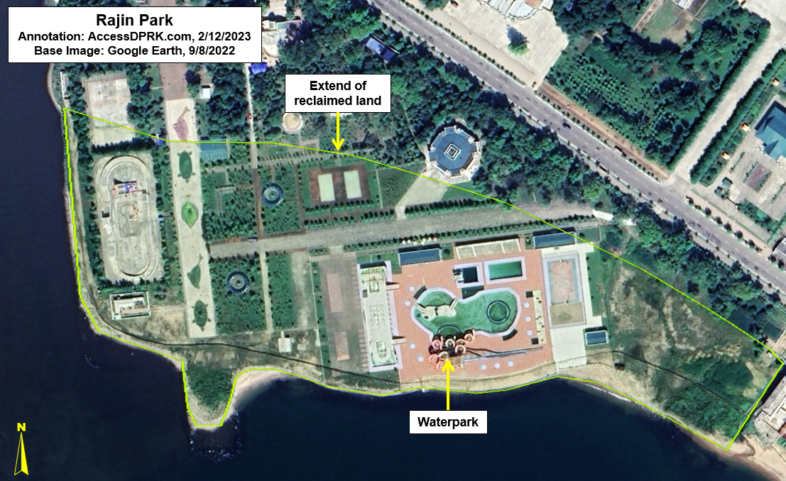
The port city of Rajin (Najin) in the Rason Special Economic Zone has seen a lot of investment since the late 2000s, with thousands of new homes, scores of businesses, and numerous parks/recreational facilities constructed in the last 15 or so years. Part of that improvement has been extending the city's waterfront.
The planned reclamation area (42.239161° 130.303417°) highlighted in the above image was initially designed by the Japanese but never carried out. However, from 2011-2013, work was done on a modified reclamation plan and 7.1 hectares were added to the city. The land was used to build decorative gardens and a waterpark.
To the north of Nanjin is Sonbong. Sonbong had traditionally been the more important of the two cities prior to the establishment of the special economic zone when it was superseded by Rajin. Still, resources have been spent on improving the city and on reclaiming land that had been a brackish lake and marshes (42.334866° 130.372910°). In total, 65 hectares have been drained since 2006.
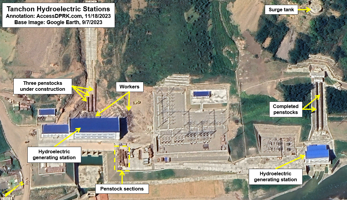
Tanchon port expansion (40.416884° 128.918915°)
Tanchon is a key city in South Hamgyong Province and is home to zinc and magnesia foundries, as well as serving as the gateway to the major Komdok mining region. Yet, it lacked modern port facilities until 2012. Including the surrounding wetlands, Tanchon's new port construction resulted in 21 hectares being reclaimed.
Some 1,500 meters of repaired and elongated breakwaters were also built to create the protected harbor.
Cha'ho Submarine Base (40.202812° 128.654004°)
North Korea has thirteen underground naval facilities, the largest are submarine bases. One such base is Cha'ho. To build the base, two tunnels were excavated for submarines and a new supply wharf was also created. The excavated spoils were used to create new land for berthing and other base activities.
In total, over 62,000 sq. meters of land was reclaimed.
KEDO Lakes (40.098358° 128.339233°)
The Korean Peninsula Energy Development Organization (KEDO) was established in 1995 to implement parts of the 1994 Agreed Framework in which North Korea was to suspend its activities at the Yongbyon nuclear facility and in return KEDO would build two light water reactors for civilian energy production.
The site chosen for these reactors is located 28 km south of Cha'ho. The site was covered by rice paddies and two small lakes. The paddies had already been created through draining portions of the lakes, but additional reclamation work needed to be done to secure the foundations for the power plant.
In total, 300 hectares of new land has been created at the site, both before and as a result of the KEDO construction project.
Unfortunately for global nuclear disarmament, North Korea violated the terms of the Agreed Framework and KEDO eventually shut down in 2006. What's left of the site is an industrial wasteland, with giant foundation trenches and piles of construction materials left over. The site seems to now be used to store raw materials like stone and sand, and occasional vehicle movements can be seen on satellite but they're unrelated to any on-site construction.
Wonsan Bay Marshes (39.409847° 127.442985°)
The largest reclamation example on the east coast involves the marshlands of the Chontan and Ryonghung rivers as they merge into a single delta and empty into Wonsan Bay.
Three tracts of land totaling 16.1 sq. km have been reclaimed since the 1980s. One tract is used as a saltern and the other two are rice paddies.
Future of Reclamation
As stated at the beginning, all of these reclamation projects have created 1,049 sq. km. of land, and that's taken 70 years. In 2012, Kim Jong Un said that he wanted land reclamation to rise to 3,000 sq. km. It's difficult to see how that goal would be possible without completely enclosing the waters between Sinmi Island and Sohae, enclosing the Chongchon River delta, and destroying the remaining bays of South Hwanghae Province. It's also difficult to see this happening within a single lifetime.
Nonetheless, despite natural disasters and financial problems, North Korea has a strong history of slow but steady land reclamation progress. Over 200 sq. km. of water have already been enclosed since 2010, and there has been improved progress at stalled projects.
Although North Korea has less arable land than South Korea, the two countries actually have a similar amount of land actively under plough. And Pyongyang is trying to solve the country's food problems through sheer volume, since it refuses to address the underlying economic policies that have left one in five young children with stunted growth due to malnourished.
As I have shown, reclaimed land is predominately used for agriculture (particularly rice and reeds), salterns, and to a lesser extent aquaculture and port facilities. While this may benefit the nation in the short-term, serious long-term questions have been raised about their sustainability and impact on coastal ecosystems.
Nearly all of the reclaimed land was built over wetlands and tidal flats, two ecosystems at-risk all around the world. Wetlands also provide buffers against storms and wave damage. Without them, typhoon storm surges can cause even greater coastal damage and flood farther inland.
If the seawalls aren't high enough, North Korea could see thousands of hectares of valuable farmland inundated as precedent has demonstrated (as with Ryongmae and elsewhere). Additionally, rising sea levels due to climate change put these sites at risk of not merely flooding but also saltwater infiltration that could make their agricultural output plummet.
There are several ways to mitigate the risks to climate change, and maintaining sufficient coastal wetlands can offset storm damage while also improving regional biodiversity. However, the North Korean government have not been forthcoming when it comes to these mitigation plans, if it has any at all.
In the face of these issues and knowing that North Korea will be reclaiming ever greater amounts of land, one must look at their overall impact with skepticism. Food security is obviously a necessary goal to achieve, but if those efforts result in the destruction of hundreds or thousands of square kilometers of wetland and tidal areas or if the new lands can't be protected from flooding, then their creation may not actually benefit future generations.
Note: if you would like the polygons from Google Earth to explore all of these sites and those I didn't include, just email me.
I would like to thank my current Patreon supporters: Alex Kleinman, Amanda Oh, Donald Pierce, GreatPoppo, Jonathan J., Joel Parish, John Pike, JuneBug, Kbechs87, Russ Johnson, and Squadfan.
--Jacob Bogle, 2/19/2023