This map gives you a broad view to help you understand their location with respect to well-known cities and islands.

In all I found 21 new sites as well as 1-2 more in the process of construction. Some of the placemarks represent two sites which are side-by-side, in total there are 24 of these "tunnels."
Here is a close-up map of all of the new locations:

The one in the center of the group can be found at 37°48'23.31"N 125°28'5.17"E. All of the other ones are within 1.5 miles of the center.
They all have the same layout, a curved entrance with a "pad" in front and they're all dug into the sides of hills. This is a detailed image of several of them in a cluster.

Also, the area has had a fair amount of new construction with new roads and new buildings.
Here is the central region on Nov 25, 2011:

The same area except on June 20, 2012:

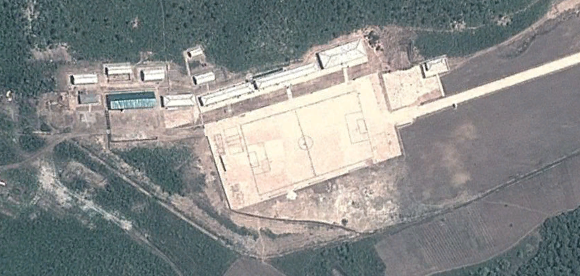
A close-up of some of the buildings:
And finally, a detailed image of the northern most region:

Based on the dates for the past imagery this entire project was built in less than a year. The location of this facility is less than 14 miles from Yeonpyeong Island, SK and less than 61 miles from Incheon International Airport and mainland South Korea.
This has been a rather unpleasant discovery.
--Jacob Bogle, 4/28/2013
www.JacobBogle.com
Facebook.com/JacobBogle
Twitter.com/JacobBogle
No comments:
Post a Comment