Thursday, August 22, 2013

Kangdong Residence

Kangdong Residence is a summer retreat and the secondary main residence of the leaders of North Korea. It is located about 19 miles from downtown Pyongyang near the border with South Pyongan Province and includes multiple houses, pools, horse tracks, a dedicated rail line, security barracks and more. Near Kangdong are two other elite residential compounds which seem to be satellite residences for other members of North Korea's inner circle. The main compound encompasses an area greater than 1.5 square miles. Between 2006-2011 several improvements and additions have been constructed (such as the trail station and an underground entrance).

Like all official residences (there are more than a dozen), security is tight. Kangdong airfield is nearby and the compound is surrounded on two sides with multiple anti-aircraft artillery sites.

You can get the full KMZ file of this compound for Google Earth here.

(click to view larger)
The above image is a large view showing everything. The main compound is off-center to the right, the dedicated rail line is in green (with another line being built [lighter color] which goes to 2 unknown facilities), the anti-aircraft artillery sites are marked with the red "A-drop" icon and the yellow & red lines are fences. 

Below, gives a less cluttered look of the defensive positions with Kim Jong-un's residence marked.


Like all official compounds, the area is ringed with successive fences. Some are basic and others are electrified with multi-layered walls and firing positions (along with a vast network of foot paths).


The purple line marks out the main walls and surrounds the primary residences. Red denotes an outer "inner" wall, yellow is the outermost fence, and green marks out other basic walls surrounding various buildings.

Here is a close-up of the main residential section. There are 19-20 homes and you can see the wide fence/wall system surrounding the area.


Here is a larger view of the main compound. 


Again, with fences showing and some places marked.


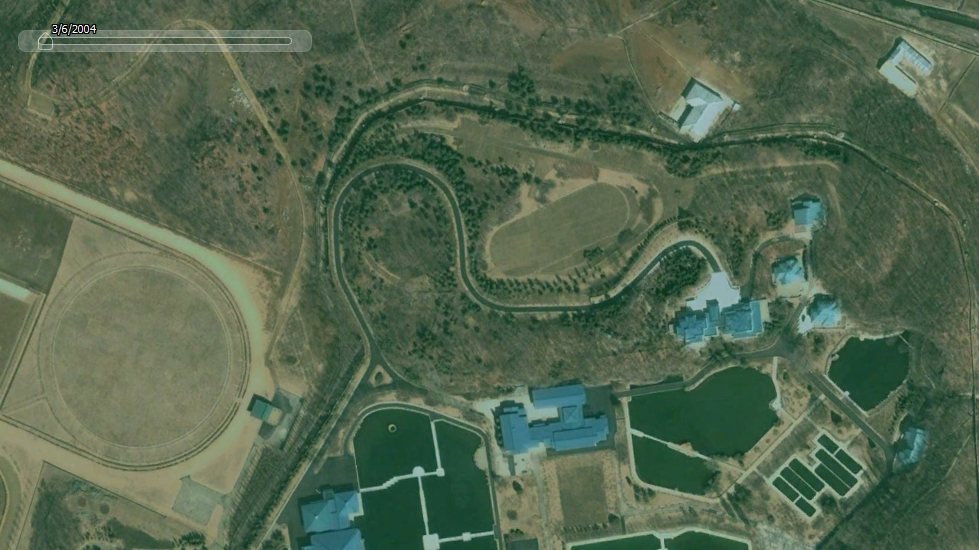
As I said earlier, there have been some additions. This is an image from 2004 showing the main residential compound, you'll notice the house I marked as possibly Kim Jong-un's isn't there and the horse track is different. There is imagery from 2006 without the additions but it was taken during winter and isn't as clear.


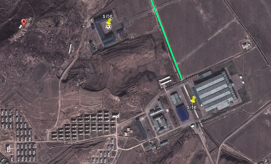
And the newly built train station.


Leading south from the train station is a road and bridge which crosses the Taedong River. Once you cross the river you come to a gate. This gate serves as one of many, but it is one of the main entrances. If you follow the northern route (take a left if you're on the road) you will end up at the main complex. If you take the road in the left of this image you will get to the first "satellite" compound (which is pictured further below).


This is a side-by-side before & after image of the underground entrance. It goes beneath the hill the new palace was built upon. The left-side image is from 2004, the right is 2011.


Scattered around the complex are storage bunkers. Based on my understanding they're used to store fuel. However, some could be used to store anything and one or two may be large enough to be used as some kind of emergency bunker in the event of a war or attack.


A close-up. The rounded areas are the actual bunkers and it has a maintenance shed nearby.


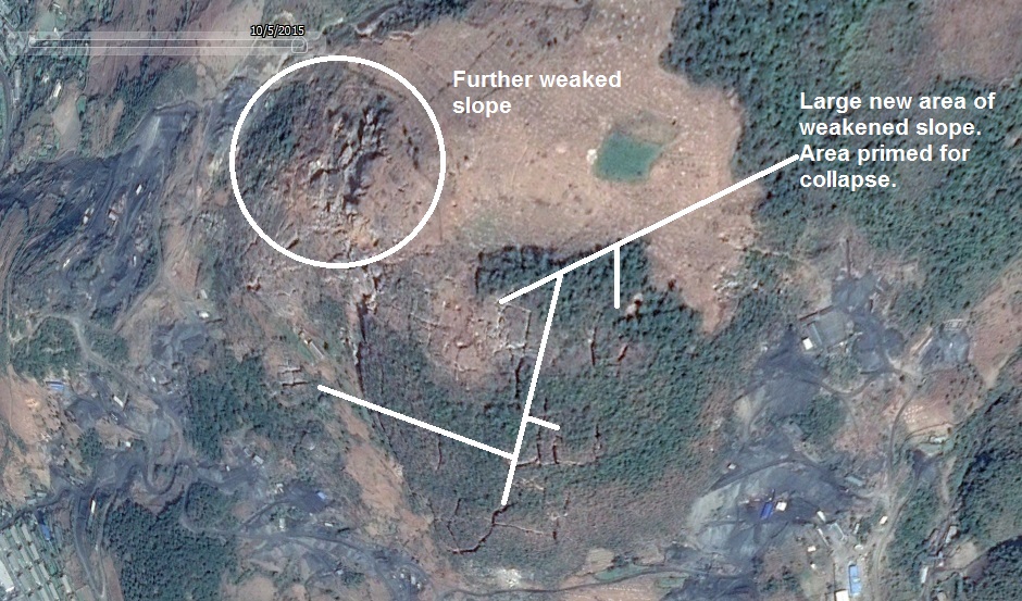
There is also a very odd and very large area next to the horse tracks which covers the floor of some small valleys between hills. It is made up of hundreds (if not more) of these rectangular structures. Each are aligned side-by-side 10 or 12 feet apart. The whole area covers more than 230,000 square feet based on my calculations. I have no idea what they are, nor does anyone else I know.


Here are the other two smaller "satellite" compounds.


And finally, a side track is being constructed off the main train track. It goes south and ends at two sets of newly constructed buildings.

Here is the area in 2010 (track path is marked).


And the facilities as seen in the latest available imagery (2011).


I hope you enjoyed this little trip around Kim Jong-un's backyard.

--Jacob Bogle, 8/22/2013
www.JacobBogle.com
Facebook.com/JacobBogle
Twitter.com/JacobBogle

Thursday, August 15, 2013

North Korea and Satellite Resolution

Google Earth pools data from many sources, weather satellites, public imaging satellites, and aerial photography, and often the information between each source is years apart. This leads to a wide variety of resolutions (0.5 meter to 2.5 m plus) and quality.

These resolution variances offer an interesting obstacle when it comes to mapping North Korea. Some of the images are merely days old with resolutions of such quality you can make out individual windows and see people walking in the streets.

(This image is about 750 feet wide)

And then there are other regions, mostly from France's National Centre for Space Studies (CNES) SPOT satellite, where the resolution is measured in meters. At this resolution you can only make out large structures, like the outline of houses.

(This image spans more than 2,500 feet)

Given the low resolution of the SPOT images, it can be almost impossible to definitively label something. Attempting to interpret an image is pointless in most cases. So, to help keep me (and others) from spending so much time scanning around trying to find an area of higher resolution, I've mapped out all of the larger low-res regions. Surprisingly, they make up a decent chunk of the country.


Once I've gone through the better quality regions, I will go over these low-res areas and mark whatever items I can find. You can download this file here.

Just for fun, I'm going to provide several examples of the different resolutions, colors, and seasons that one can find while exploring North Korea.

This is Pukchong, South Hamgyong. It is split between SPOT imaging and higher resolution images.

A town during winter

From MapABC, a Chinese company. Notice the poor coloration.

The same area in 2010 from Digital Globe 

Battle of Pochonbo Monument

Monument closeup 

A forest

And this is an example of what I call "foggy" imagery. I don't know what causes it, but it has nothing to do with actual fog/smog etc. It annoys me to no end because it makes it difficult to pick out certain features, like monuments or propaganda signs. Plus, it's just rough on the eyes.


--Jacob Bogle, 8/15/2013
www.JacobBogle.com
Facebook.com/JacobBogle
Twitter.com/JacobBogle

Tuesday, June 18, 2013

North Korean Mining

Updated Version - May 6, 2016

(Partial map of mines)

North Korea is surprisingly rich in minerals and coal. Mined materials makes up the bulk of trading, and according to various estimates the treasures underneath the ground are worth upwards of $10 trillion (250 times larger than their current GDP).

There are two types of mine, the large industrial scale mines (like that at the Geomdeok zinc mine and the Musan iron mine) and then there are the countless smaller mines throughout the country, mostly coal mines, which are largely dug by hand. Due to equipment failures, flooding, lack of spare parts etc. most mines operate far under capacity. Regardless of the difficulties, mining is one of the major economic sources for the country.

Here is an example of large-scale mining. Located north of Pyongyang, near the city of Sunchon in South Pyongan Province. This image covers an area 17 miles wide and includes multiple mining complexes.


Here is a close-up of one of the secondary mines in this complex


This is one of the larger mines in the area, unlike all the others this one is primarily mining minerals for cement. There are smaller coals mines here as well.


This is a large cement factory.


As with many large-scale industrial regions, military security is always tight. Pukchang Airbase is nearby.


Complete with fighter jets and underground hangers.


As I said, most mines are not massive, they're not mining with million dollar machines or explosives, they're mined by human strength alone, often with hand-fashioned tools. In the Songbun class system, those in the lowest class or "wavering class" are often assigned the most difficult and dangerous jobs: mining, farming, construction etc. North Korea has one of the worst human-rights records in history, possibly coming in at number one (even over Nazi Germany) when you look at the entire population. Worker's rights aren't really given much thought when it comes to the lower classes (despite the socialist mantras). Uranium miners for example have a high risk of developing cancers and severe birth defects. Coal miners will suffer from respiratory disease and skeletal problems after years of squatting in small, hand-dug, tunnels and moving tons of rock and coal.

From 2006 to 2010 coal mining has risen sharply from 23 million tons in 2006 to 41 million tons in 2010. This is in response to the energy crisis facing the country and the need to increase trade to places like China, which is the North's leading trading partner receiving 67% of North Korea's exports.

Here some examples of the more typical small mines.


And finally, this is a mine I found near Yongyon-ni in North Pyongan Province. It shows a side-by-side of the mine in 2006 and in 2010 which shows increased activity. Although the mine is relatively small, in my mind it underscores the country's attempts to secure the nation's energy supply (even if they're not succeeding), an energy supply which is notoriously lacking.


UPDATE

As I stated earlier, human life isn't the most important thing when it comes to the North Korean government. The country's mining operations continue to grow, and with it, so do the problems.

You can see small collapsed areas at many of the countries coal mines. With antiquated technology and safety taking a back seat, tunnel collapses are common. Miners are forced to work long hours and that contributes to accidents. Another side of all of this is the fact that mining plays a key role in the country's prison camp and "re-education" system, the workers are then subjected to incredibly cruel conditions. Additionally, many mining towns have a greater internal security apparatus to ensure the "free people" of North Korea stay inside the mining zone. Check points and road blocks are often added to the usual round of domestic spying and movement controls. This means that residents can neither flee nor demand better conditions.

While continuing my mapping project, I came across a coal mine in the Pyongyang region (approx. 22 miles/35km east of downtown) that got my attention. In 2015, I documented a kilometer wide landslide in a rural area near Mt. Chilbo National Park. But that was just a natural event after a storm. This new discovery on the other hand, really makes me worried.

The mine, located at 39° 2'39.39"N 126°10'4.89"E, has multiple tunnels that seem to have completely undercut the natural ability of the mountain to support itself. The summit has an elevation (according to Google) of 1,000 feet (305 m), the main part of the mine is located at the southern flank; its summit rises some 350 feet (107 m) above the bulk of the tunnels.

Over the course of 10 years, you can see a dramatic change in the mine.

This first image is from Nov. 16, 2005.


This next image is dated Sept. 5, 2015 and shows some drastic changes. The larger pieces have surface areas as large as 5,000 square feet (464 sq. m) and even 12,000 sq. ft. (1,114 sq. m).


Based on the rate of change, without drastic intervention it is highly likely that there will be a major collapse/landslide that could kill hundreds of people in just a few years. Within the valley beneath this mine lies the city's downtown core and the only road and rail link connecting the city to the rest of the area. A heavy rain could one day unleash hundreds of thousands of tons of rock and earth onto those living below.


Additional reading

Sunday, April 28, 2013

New Military Constructions for Artillery

I was going about my business mapping North Korea when I came across an odd set of trenches, and then more of them and more. After looking at their design it became somewhat obvious that these were new hardened emplacements for artillery.

This map gives you a broad view to help you understand their location with respect to well-known cities and islands.


In all I found 21 new sites as well as 1-2 more in the process of construction. Some of the placemarks represent two sites which are side-by-side, in total there are 24 of these "tunnels."

Here is a close-up map of all of the new locations:


The one in the center of the group can be found at 37°48'23.31"N 125°28'5.17"E. All of the other ones are within 1.5 miles of the center.

They all have the same layout, a curved entrance with a "pad" in front and they're all dug into the sides of hills. This is a detailed image of several of them in a cluster.


Each entrance is 21-24 feet wide and from the entrance to the access road is around 100 feet. All of the access ramps are aligned so that the entrances are either facing the north or west.

Also, the area has had a fair amount of new construction with new roads and new buildings.

Here is the central region on Nov 25, 2011:


The same area except on June 20, 2012:


A close-up of some of the buildings:


And finally, a detailed image of the northern most region:


Based on the dates for the past imagery this entire project was built in less than a year. The location of this facility is less than 14 miles from Yeonpyeong Island, SK and less than 61 miles from Incheon International Airport and mainland South Korea.

This has been a rather unpleasant discovery.


--Jacob Bogle, 4/28/2013
www.JacobBogle.com
Facebook.com/JacobBogle
Twitter.com/JacobBogle

Saturday, April 27, 2013

Coastal Defenses

North Korea's coasts are littered with defensive positions, a hodgepodge collection of modern defenses mixed with those remaining from the Korean War.

Their design takes a layered approach and is dependent on the topography of the area. Naturally, locations closer to the DMZ and those along the eastern coast (facing the historical enemy of all Korea, Japan) are more built up. To the southwest, the land border between North and South Korea gives way to a series of river mouths and tidal inlets, most notably at the confluence of the Imjin and Han rivers. This area opens up to the sea and is where I consider the North Korean coast in this region to being.

Within 3 miles of the Northern Limit Line (the de facto maritime border between the two countries, although it is disputed) are a series of observation posts located along the river banks, fences to the rear of the posts, a number of sand berms which divide up the patty fields, successive layers of road blocks/tank traps, and mixed throughout are anti-aircraft artillery sites (AAA), gun lines, trenches dug into the hills, and hardened artillery sites (HARTS). There are also ammunition caches and other storage facilities dispersed throughout.

Here is a sample region.

(click images for larger view)

The Northern Limit Line runs in the middle of the river, naturally South Korea is to the south. The wider yellow line is the area I have marked as encompassing most of the border defenses which include the DMZ. It is approximately 3 miles (with some variation) from the NLL and the Military Demarcation Line which serves as the land border. The "P" icons are small position, observation posts etc. The red circles are HARTS positions, the "S" icons are storage facilities, "F" is for fortifications, the pink icon denotes bunkers or tunnels and the "policemen" mark road blocks of the type I discussed in this post

Here is an example of the sand berm and fence which runs the length of this region (as well as nearly all low-lying coastal areas).


To the north of this beach, in an area about 5 miles wide, there are 8 road blocks.


Now, moving away from the NLL here is a map of some of the small coastal positions located along the coast of South Hwanghae province. 


The island to the bottom right, labeled Keunyeonpyeong-do (also known as Yeonpyeongdo), is the South Korean island which was bombed by the North in 2010 which killed 4 and wounded 18 others. 

This is a close up of one of the larger positions. 


Literally thousands of miles worth of trenches can be found throughout the county. Some are left over from the Korean War and have no real use, but others are part of their active defenses. Like these:


Both east and west coasts are intermittently lined with obstacle courses aimed at preventing any rapid movement inland during an invasion. These "dragon's teeth" consist of row after row of concrete blocks which have been sunk into the sand. The rows, usually 10 running parallel to each other, make up a full "band" around 100 feet wide. Most of these were put in place decades ago, some have been removed and others still have simply been covered up with drifting sand and mud. Still, in some areas they would slow an advancing force. They tend to be found in low-lying areas which lack mountainous terrain within a few miles of the coast and they are often paired with road blocks and berms further inland as well as rows of berms along the beach itself.

In this example the obstacle band has been marked in red, you can see the multiple sand berms in nice little rows.


And a close-up of the dragon's teeth themselves:


Next is the defensive positions around a few coastal towns. If you look at the coastal defense map I gave you above, this area is roughly the 4 blue places marks in a cluster, to the north of Yeonpyeongdo Island. 


The blue lines are fences and the three red lines are the tank traps. As before, the red circles are HARTS, the blue marks are small positions, "G" is a gun line and "B" is a coastal battery.

Finally, these are just three additional images of some interesting coastal places:

An AAA site with trenches - 


A close-up of a hardened artillery site - 


And a reserve fleet of 10 ships. There are a number of these types of locations dotted around the coast. Some are just sitting in dry docks like these and others are actually housed in underground naval yards.


--Jacob Bogle, 4/27/2013